
Postal code 3615 Population 990 (2004) | Time zone CET (UTC+1) Local time Saturday 7:28 AM | |
 | ||
Weather 11°C, Wind SE at 8 km/h, 87% Humidity | ||
Westbroek is a village in the Dutch province of Utrecht. It is a part of the municipality of De Bilt, and lies about 6 km northwest of Bilthoven.
Contents
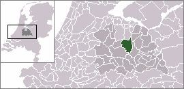
Map of Westbroek, Netherlands
In 2001, the village of Westbroek had 510 inhabitants. The built-up area of the village was 0.12 km², and contained 178 residences. The statistical area "Westbroek", which also includes the peripheral parts of the village, as well as the surrounding countryside and the village of Achttienhoven, has a population of around 1300.
Westbroek consists mainly of a ribbon of farms along a dike. The village is surrounded by a number of polders: the Polder Westbroek, the Kerkeindse Polder, and the Polder Achttienhoven in the north, and the Molenpolder and Polder de Kooi in the south. The Molenpolder is a nature reserve.
History
Westbroek used to be a separate municipality. It merged into Maartensdijk in 1957, and has been a part of the De Bilt municipality since 2001.
The church dates from 1467.
On 26 December 1481, Westbroek was the site of a major battle, known as the Battle of Westbroek, between the armies of the prince-bishopric of Utrecht and Holland, with Holland winning a decisive victory.