
Area 983.6 km² | Time zone IST (UTC+05:30) Population 988,192 (2011) | |
 | ||
Ethnicity Bengali, Tripuri, Chakma, Other Colleges and Universities Tripura University, National Institute of Technolo, Maharaja Bir Bikram College, Agartala Government Medical, Tripura Institute of Technology Points of interest Ujjayanta Palace, Tripura Government Museum, Rabindra Kanan, Rose Valley Amusem, Jagannath Bari | ||
West Tripura (Bengali: পশ্চিম ত্রিপুরা জেলা) is an administrative district in the state of Tripura in India. The district headquarters are located at Agartala. As of 2012 it is the most populous district of Tripura (out of 8). While Tripura as a whole lies approximately between the north latitude 22 degrees 56' and 24 degrees 32' and between longitude 91 degrees 0' and 92 degrees 20' east, the West Tripura district lies approximately between latitude 23 degrees 16' to 24 degrees 14' north and longitude 91 degrees 09' east to 91 degrees 47' east. The West Tripura District is bounded by Bangladesh in the north and west by Khowai district in the east and by Sepahijala district in the south. Total area of the district before 2012 was 3544 sq.km but with effect from 21 January 2012 four more new districts was divided making a total of 8 districts in the state and hence West Tripura contracted to 983.63 sq.km. The district headquarters is located at Agartala, which is also the capital of the State.
Contents
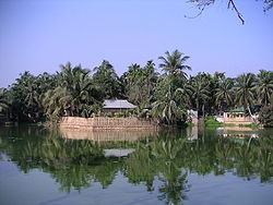
- Map of West Tripura Tripura
- History
- Geography
- Physical features
- District Profile
- Divisions
- Lok Sabha constituencies
- Religion and Demographics
- Flora and fauna
- References
Map of West Tripura, Tripura
History
Tripura was a princely State. Maharaja Ratna Fa was the first king and Bir Bikram Kishore Manikya was the last King. After the death of Bir Bikram Kishore Manikya in May 1947, a council of regency under the leadership of his widowed wife Maharani Kanchanpura Devi took over charge of administration on behalf of the minor prince Kirit Bikram Kishore Manikya.
Monarchy came to its end on 9 September 1947. Tripura was taken as a Part-C state administered by Chief Commissioner. Tripura became a Union Territory on 1 November 1956. The Territorial Council was formed on August 15, 1959. The dissolution of Territorial Council and formation of Legislative Assembly and a Council of Ministers in July 1963 were notable events. Finally Tripura became a full-fledged State in January 1972. The district administration was run by one District Magistrate and Collector up to 31.8.1970. For better attention of problems of land and tenancies, for accelerating the pace of development in this backward area especially in the remote Tribal areas and for bringing the people closer to the administration Tripura was divided into three districts, viz., North Tripura District, West Tripura District and South Tripura District. Three district Magistrates and Collectors were appointed for the three districts from 1-9-1970. R Ghosh (IAS) from 5 November 1951 to 26 September 1954, During the period Tripura had only one district and formation of three district (West Tripura, North Tripura and South Tripura) in 1 September 1970, Magistrate was Omesh Saigal (IAS) (from 5 May 1967 to 21 May 1971). While it was one District Union Territory there were 10 sub-divisions. When it became a full-fledged State, the 10 sub-divisions remained the same. The West Tripura district comprises three sub-divisions viz., Khowai, Sadar and Sonamura while North Tripura District comprises Kailashhar, Dharmanagar and kamalpur and South Tripura District comprises remaining Udaipur, Amarpur, Belonia and Sabroom sub-divisions. Out of the six principal hill ranges namely Baramura and part of Athramura fall within the district.
Geography
Tripura was known as 'Hill Tipperah' and the very much nomenclature is suggestive of its hilly nature of undulating surface made uneven by inter-sparsed low hills. A series of hill ranges running north and south divide the territory into broad parallel valleys, consisting of undulating tillas (hillocks) covered with jungle with totuous streane. There are six principal hill ranges in the State increasing in height as one moves west to east (from the sumit of the ranges one has a striking view of the surroundings, a heaving monetary of evergreen landscape). Out of the six principal ranges, Baramura and Deotamura ranges and Atharamura ranges partly fall within West Tripura.
Baramura Deotomura Range : The portion of the above ranges lying in West Tripura District is the Baramura range which is almost 47 km. having the highest peak Saisum Sib (249 m)
Atharamura Range : This range starts from Amarpur Sub-division of South Tripura District and then enters into the Khowai Sub-division of West Tripura and runs along the border of WEst Tripura and North Tripura District. Its highest peak in the West Tripura District is Niungnanwra (481 m) The district occupies an area of 2997 km²
Physical features
It is true that the State as a whole was, in the bygone days, far richer in forest wealth but with the increasing pressure on land through population increase has rendered this rich forest susceptible to decay, through the process of reckless felling of the trees for different reasons like settlement of land use and jhumes in some cases and for also augmenting the revenue of the erstwhile princely State even since the past great wars. With the increase in population, the pressure on land was intensive and the tall tress of the forest had to give way to the increasing need to settling the refugees who came in exodus to this tiny state as well as for maintaining jhum cycle for the considerable percentage of Tribal who still continues to practice jhum cultivation. Without being scholarly to discuss the extent of ecological imbalances created by such indiscriminate exploitation of forest for immediate reasons, it is very much clear that the State has suffered quite heavily in the forest wealth during the past decade. The experimentation for introduction of rubber plantation, which was found suitable for the soil and climatic condition of the State has also proved to be successful and thus brightened the prospect of this sector which might go a long way in the total economic development of the State as a whole. The total area under rubber plantation has been increased to 3320.77 hectares from the experimental minimum of 5.80 hectares in 1963. The Tripura Forest Development and Plantation Corporation Limited, a public sector enterprise under the State Government have also taken intensive programme of development of rubber plantation in the whole state as well as West Tripura District.
Coffee plantation is another addition in the sector which has attained a coverage of 10183 hectares in 1981 from 2.40 hectares in 1975. Tripura, being a land locked State is having constraint in importing coal for domestic use. The extent of fire-wood supplied from forests is about 177000 cu.m. The supply of firewood from the forest is also a main source of livelihood for the population residing in the interior forest area. The quantity of timber produced from the forest as in 1980-81 is about 37204 cu.m As stated earlier, the details for the district in particular are lacking but the overall picture of the State will reflect the position as obtained in the West Tripura District.
District Profile
The information provided below are taken from a book based on 2012 statistics, all the names, infos, details, etc are in effect from and on 2012
Divisions
West Tripura District has Sixsub-divisions:
West Tripura District has 16 Blocks:
Lok Sabha constituencies
West Tripura district is located in two Lok Sabha constituencies: Tripura West (shared with South Tripura district), and Tripura East (shared with South Tripura, Dhalai and North Tripura districts).
Religion and Demographics
According to the 2011 census West Tripura district has a population of 1,724,619, roughly equal to the nation of The Gambia or the US state of Nebraska. This gives it a ranking of 281st in India (out of a total of 640). The district has a population density of 576 inhabitants per square kilometre (1,490/sq mi) . Its population growth rate over the decade 2001-2011 was 12.5%. West Tripura has a sex ratio of 964 females for every 1000 males, and a literacy rate of 88.91%.
Flora and fauna
In 1987 West Tripura district became home to the Sipahijola Wildlife Sanctuary, which has an area of 18.5 km².