
Country Netherlands Elevation 7 m (23 ft) Website www.westmaasenwaal.nl Area code 0487 | Established 1984 Time zone CET (UTC+1) Area 85.21 km² Local time Saturday 3:16 AM | |
 | ||
Postcode 6620–6621, 6626–6629, 6657–6659 Weather 11°C, Wind SE at 5 km/h, 89% Humidity Points of interest Museum TweeStromenland, Stoomgemaal De Tuut, Heerlijkheid Appeltern | ||
West Maas en Waal ( pronunciation ) is a municipality in the Dutch province of Gelderland.
Contents
Map of West Maas en Waal, Netherlands
The municipality covers the western part of the Land van Maas en Waal, an island located between the Meuse and Waal rivers.
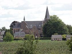
Population centres
Dutch Topographic map of the municipality of West Maas en Waal, 2013.
Demographics
References
West Maas en Waal Wikipedia(Text) CC BY-SA