
Website Official website Literacy 53% | Area 1,693 km² | |
 | ||
Colleges and Universities Northeast Adventist College, Thomas Jones Synod College Major highways National Highway 44, National Highway 40 Points of interest krang shuri waterfall, Nartiang Monoliths, Nartiang Durga Temple, Tyrshi Falls, Tdem Falls | ||
West Jaintia Hills (Pron: ˈʤeɪnˌtɪə) is an administrative District in the state of Meghalaya in India. The united district (Jaintia Hills District) was created on 22 February 1972 and occupied an area of 3819 km2. It had a population of 295,692 (as of 2001). The district is part of the Meghalaya subtropical forests ecoregion.With the bifurcation of the erstwhile Jaintia Hills District into East and West Jaintia Hills Districts, West Jaintia Hills District came into existence on 31 July 2012 with its headquarters at Jowai. Jowai is the host of all the heads of important governmental offices and establishments, educational institutions, hospitals, banking institutions, etc.
Contents
- Map of West Jaintia Hills Meghalaya
- Geography
- Economy
- Administrative divisions
- Transport
- Demographics
- Languages
- Places of interest
- Education
- References
Map of West Jaintia Hills, Meghalaya
Geography
The total area of the district is 1693 km2. The district comprises one Civil Sub-Division Viz. Amlarem Civil Sub-Division and three Community and Rural Development Blocks viz. Amlarem C&RD Block, Laskein C&RD Block and Thadlaskein C&RD Block with the following boundaries:
Economy
Although the mainstay of the district is agriculture, however, due to the abundance of Limestone, plenty of Cement factories have been set up in the district (now East Jaintia Hills). More are set to come up. Coal mining at sites like Lad Rymbai(East Jaintia Hills district) is also one of the major activities set up here.Coal mined here is mostly exported to Bangladesh and Assam. Most of the coal mining sites are now situated in the East Jaintia Hills district.
Administrative divisions
United Jaintia Hills district was divided into five blocks. With the bifurcation of the erstwhile district, West Jaintia Hills is divided into three blocks:
East Jaintia Hills district is divided into two blocks, namely:
Transport
Since it is land locked region and lack of railways and airport, the only means of transportation is roadways. The main highway which runs through the district is NH 40 and NH 44.
Demographics
The district has a total population of 270,352, of which 134,406 are males and 135,946 are females. The density of population is 159.69 per km2.
Languages
The common dialect in West Jaintia hills is Pnar, belonging to the Jaintia language. Other dialects include War Jaintia speaking to the southern part of the district and Biate, spoken by approximately 20,000 members of its namesake tribe. The Biates also resides in the Saipung elaka in East Jaintia Hills district, and are believed to have similar culture to that of the Mizo tribe. It is said that their language is also very similar to that of the Mizos. Moreover, their dress is very similar to that of the Naga and Mizo tribes.As per The Scheduled Castes and Scheduled Tribes Orders (Amendment) Act, 1976 and The Constitution (Scheduled Tribes) Order (Amendment) Act, 1987, the Biates are listed as one of the Kuki tribes.
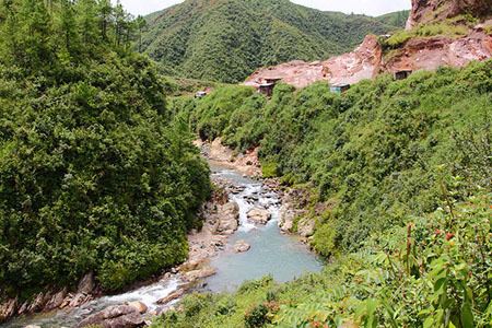
Places of interest
West Jaintia Hills boasts of exquisite natural beauty. Few of the places of interest in Jaintia hills are listed below:
Education
Although West Jaintia Hills is not known as an education hub. Good schools and colleges do exist in Jowai, Khliehriat and Nongtalang. Prominent Colleges in West Jaintia hills include Jowai Polytechnic A reputed and the only Nursing School in the district namely Dr. Norman Tunnel Hospital School Of Nursing, Thomas Jones College, Nongtalang College and Kiang Nangbah Govt. College Jowai which offers degree courses in arts and science. Jowai has good schools too for Secondary and Higher Secondary level.