
Country India District Jaintia Hills Time zone IST (UTC+5:30) | Block Khliehriat Climate Cwa | |
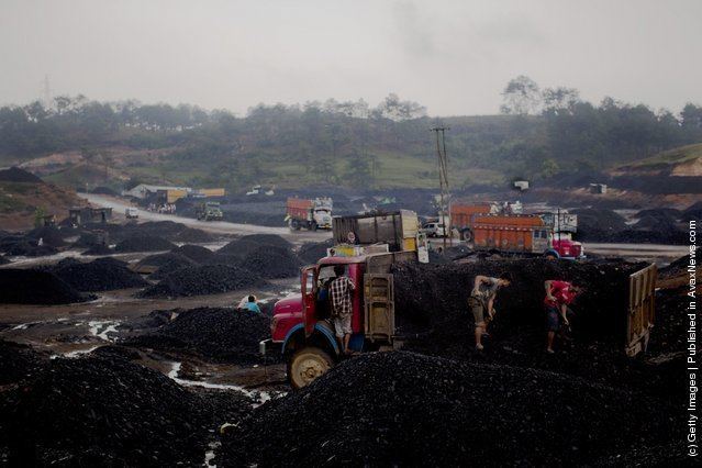 | ||
Lad Rymbai is a town in the East Jaintia Hills district of Meghalaya, India. It is a coal mining site, located along the National Highway 44.
Contents
Map of Lad Rymbai, Meghalaya 793160
History
Lad Rymbai is Jaintia for "junction to the Rymbai village". Originally, a small village, it emerged as a town with the completion of the National Highway 44, which made the village a transit point for vehicles operating between Guwahati and Silchar. The highway also made it possible for the businesses to exploit the local coal and limestone deposits, leading to the development of an unregulated mining industry.
Economy
Lad Rymbai is an important market of the district, and is located at a distance of 30 km from the district headquarters Jowai.
Demographics
The Pnar tribe are the native inhabitants of the village, which also attracts seasonal migrant coal workers from Bihar, Nepal and Bangladesh.
Administration
Ladrymbai comes under the Khliehriat block and electoral constituency. The Ladrymbai post office serves the villages of Bataw, Mukhialong, Musniang, Rymbai, Sham Sham, Sohkhympher, Tuber Khamaishnong and Wapung.