
Total islands 14 | ||
 | ||
Islands Similar | ||
West frisian islands meaning
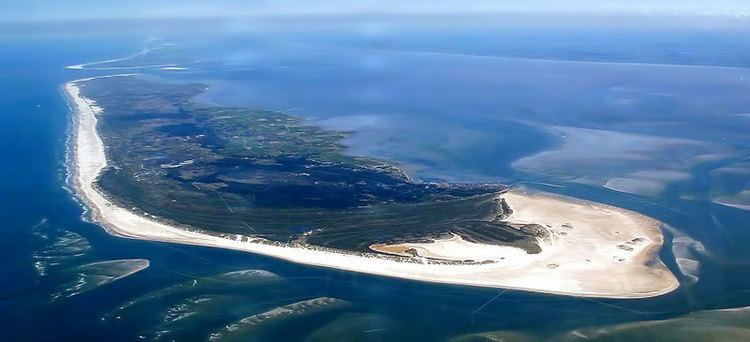
The West Frisian Islands (Dutch: Waddeneilanden; West Frisian: Waadeilannen) are a chain of islands in the North Sea off the Dutch coast, along the edge of the Wadden Sea. They continue further east as the German East Frisian Islands and are part of the Frisian Islands.
Contents
- West frisian islands meaning
- Map of West Frisian Islands Netherlands
- North sea beach at ameland west frisian islands
- Geography
- References
Map of West Frisian Islands, Netherlands
From west to east the islands are: Noorderhaaks, Texel, Vlieland, Richel, Griend, Terschelling, Ameland, Rif, Engelsmanplaat, Schiermonnikoog, Simonszand, Rottumerplaat, Rottumeroog, and Zuiderduintjes.
The islands Noorderhaaks and Texel are part of the province of North Holland. The islands Vlieland, Richel, Griend, Terschelling, Ameland, Rif, Engelsmanplaat, and Schiermonnikoog are part of the province of Friesland. The small islands Simonszand, Rottumerplaat, Rottumeroog, and Zuiderduintjes belong to the province of Groningen.
The Frisian Islands are nowadays mostly famous as a holiday destination. Island hopping is possible by regular ferries from the mainland and by specialised tour operators. Cycling is the most favourable means of transport on most of the islands. On Vlieland and Schiermonnikoog cars are allowed only for regular inhabitants.
North sea beach at ameland west frisian islands
Geography
The island chain represents the remains of a glacially formed sandbank, and may have once been the former coastline of Holland, before it was breached and flooded to form the Waddensee many thousands of years ago.