
Demonym(s) Vlielander Postcode 8899 Area 315.8 km² | Elevation 3 m (10 ft) Time zone CET (UTC+1) Website www.vlieland.nl Local time Tuesday 6:28 PM Area code 0562 | |
 | ||
Weather 12°C, Wind NW at 13 km/h, 78% Humidity Points of interest Vuurduin, Eierland Lighthouse, West Frisian Islands, Museum Tromp's Huys, Vuurtoren Vlieland | ||
Beachlanding at vlieland by royal netherlands marine corps 27 05 2015
Vlieland ( [ˈvlilɑnt]; West Frisian: Flylân) is a municipality and island in the northern Netherlands. The municipality of Vlieland has only one major town: Oost-Vlieland (West Frisian: East-Flylân). It is the second-least densely populated municipality in the Netherlands (after Schiermonnikoog).
Contents
- Beachlanding at vlieland by royal netherlands marine corps 27 05 2015
- Map of Vlieland Netherlands
- Sunreef 58 in vlieland the netherlands sunreef 58
- History
- Travel
- Climate
- Landscape
- Towns
- Tourism
- References
Map of Vlieland, Netherlands
Vlieland is one of the West Frisian Islands, lying in the Wadden Sea. It is the second island from the west in the chain, lying between Texel and Terschelling. The island was permanently separated from the mainland in St. Lucia's flood in 1287. Vlieland was named after the Vlie, the seaway between it and Terschelling that was the estuary of the river IJssel in medieval times.
Sunreef 58 in vlieland the netherlands sunreef 58
History
The northern part of the island of Texel, Eierland, once was the southwestern part of Vlieland. A storm surge in 1296 probably separated Eierland from Vlieland. Erosion further diminished the size of Vlieland from the west, leading in 1736 to the disappearance of a second village on Vlieland, West-Vlieland (Westeijnde), after the inhabitants had tried for decades to rebuild the town following numerous floods.
Until 1942 Vlieland, like Terschelling, was part of the province of North Holland. During the Second World War, Vlieland became part of the German Atlantic Wall. The Germans built two anti-aircraft batteries and stationed more soldiers on the island than there were inhabitants. They also repartitioned the island to Friesland and the situation was not reversed after the war. The mail station in the western part of the island is a reminder that in the past mail was delivered by ferry from Texel.
Because of this history, Vlieland natives do not speak Frisian. The original dialect, Vlielands, was related to the dialect of Texel and to other Dutch dialects in North Holland. The last native speaker, Petronella de Boer-Zeylemaker, died in 1993 at the age of 107.
Travel
Vlieland can be reached by ferry from the Frisian town of Harlingen on the mainland. Ferries are operated by Doeksen and the journey takes 45 minutes to 1.5 hours to cross the Wadden Sea and part of the North Sea. Tourists are not allowed to bring cars with them on the ferry. A summer-only ferry service runs between De Cocksdorp on the neighboring island of Texel and the westernmost point of Vlieland. The most common form of transport on the island is the bicycle; a network of cycle paths criss-crosses the island. A bus service runs from the ferry terminal to the village and campgrounds after the arrival of a ferry, and some time before departure. There is a very small heliport near the village, but it is only used for SAR flights.
Climate
Vlieland, being the outermost of the Frisian barrier islands, sees its climate the most moderated by the North- and Wadden Sea. As is the case with the other West Frisian islands, sunshine hours are among the highest in the Netherlands, and quite possibly among the highest in the North Sea basin. Temperature extremes are rare; on average only 6 times a year does the daytime high exceed 25 degrees, and a high above thirty happens on average only once every three years. This also counts for extreme cold; only on five days a year does the temperature stay below zero for a whole 24-hour period, and nighttime frost happens on less than 40 nights a year. Nights below -10 Celsius only happen on average once every 2 years. Wind is abundant however, the average wind speed on Vlieland is almost 8 metres per second, or 28 kilometres per hour. Gale-force winds occur on average nine days per year.
Landscape
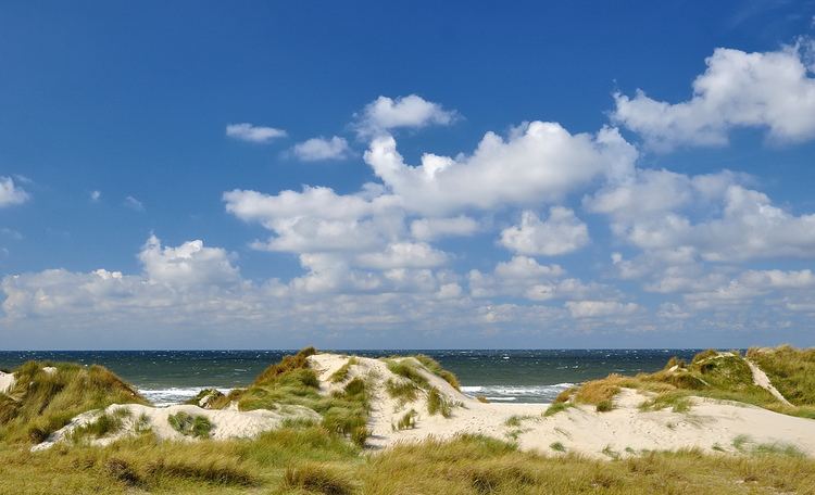
The majority of the landscape of the island consists of dunes, but there are some wooded areas and small meadows. A large part of the island, the western part, consists mainly of sand.
Towns
There is only one village on the island, Oost-Vlieland. A second village, West-Vlieland, was lost to the sea in 1736.
Tourism
Tourism is the main source of income on Vlieland. There are approximately 15 hotels, and several hundred apartments and holiday homes. Vlieland has two campgrounds.
Into The Great Wide Open is an all ages pop festival held in late April and in late August. The festival is an open family gathering of good music, visual arts, film, oysters and Mother Nature in all its grandeur.