
OS grid reference TQ333722 Sovereign state United Kingdom Dialling code 020 | London borough SouthwarkLambeth Postcode district SE21 | |
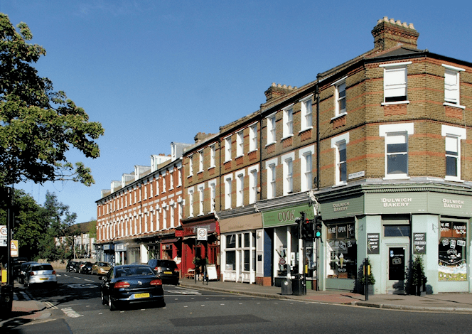 | ||
hd ts2015 evening peak at west dulwich
West Dulwich is an area in south London, England, which straddles the London Borough of Lambeth and the London Borough of Southwark. Croxted Road and South Croxted Road mark the boundary between Southwark to the east and Lambeth to the west. The suburb of West Dulwich dates back to the 17th century when the often flooded land known as Dulwich Common was acquired and drained by Edward Alleyn's estate.
Contents
- hd ts2015 evening peak at west dulwich
- Map of West Dulwich London UK
- Transport
- Politics
- Green spaces
- Knights Hill
- Schools
- Sport and leisure
- Timeline
- Buildings of interest
- Notable residents
- Nearest places
- References
Map of West Dulwich, London, UK
West Dulwich has two main parades of shops, the main one being on the Park Hall road junction, where Croxted Road becomes South Croxted Road. Shops there include Tesco, and a number of high end or independent shops. The other parade is on Rosendale Road and has more local-style shops. The Rosendale pub was redeveloped into a gastropub and was awarded the title of TimeOut London Best Gastropub 2007. Another building of note is Beauberry House, which is set in the grounds of Belair Park opposite West Dulwich railway station. The former mansion is now a restaurant.
On the fourth Sunday of every month there is a farmers' market in the grounds of Dulwich College.
Transport
At off-peak times West Dulwich railway station is served by four trains per hour into Victoria station. At peak times there are trains to both Victoria and Blackfriars. The closest tube station is Brixton tube station, which is approximately 20 minutes away by bus. The bus routes, 3, P4, P13, 201 and 322 pass through the area. The routes 176, 185 and 197 go down nearby Lordship Lane, in East Dulwich, with the routes 37 and 42 in nearby North Dulwich.
Politics
West Dulwich forms part of the Dulwich and West Norwood constituency whose current member of Parliament is Helen Hayes MP of the Labour Party. At the local government level, West Dulwich is split between College Ward, East Dulwich and Village Ward in London Borough of Southwark and Gipsy Hill Ward and Thurlow Park Ward in London Borough of Lambeth. Dulwich is traditionally a Conservative area, although in recent years they have faced competition from the Liberal Democrats. Currently three of the nine Dulwich councillors are Conservative: two in Village ward and 1 in College ward with the Liberal Democrats holding East Dulwich and the other Village seat while Labour have the other 2 College seats.
Green spaces
Dulwich Wood, Dulwich Park and Brockwell Park are all within walking distance of West Dulwich. Thurlow Park and Belair Park are by the south circular where it enters and leaves the area. Being so close to Dulwich Village means that there are many small pockets of greenery such as those on Park Hall Road, Rosendale Road and College Road.
The Rosendale Allotments, which were established in 1908, are on a 18-acre (73,000 m2) site owned by the Dulwich Estate on the eastern side of Tulse Hill between Herne Hill and Knight's Hill.
The Old College Lawn Tennis and Croquet Club is on the east side of Gallery Road.
Knight's Hill
Confusingly, there are two areas called Knight's Hill nearby; the better known area is the residential area and electoral ward in West Norwood by the road called Knights Hill. But there is a hill to the north, near Thurlow Park Road, known as Knight's Hill, in which is the Knight's Hill railway tunnel. This second Knight's Hill includes the hilly land between the western end of Thurlow Park Road (South Circular), Peabody Hill and Lovelace Road, where the adjoining Rosendale allotments in Dulwich stand today. The green area is still marked as Knight's Hill on detailed maps, but to avoid confusion is not normally named on modern streetmaps. Both areas have similar origins, first mentioned as belonging to Thomas Knyght in 1545, and were known as Knight's Hill Common and Knight's Hill Farm, respectively. The train line between North Dulwich railway station and Tulse Hill railway station runs through the hill. Today the Peabody Hill estate lies on the western side of Tulse Hill with the Rosendale Road allotments on the top.
Schools
Although renowned for excellent independent schools at all age levels, there is inadequate state schools provision. Added to this is the fact that residents in West Dulwich will live either in Southwark or Lambeth and therefore their choice of schools is limited even further. Within West Dulwich, there are four state primary schools (Rosendale Primary School and three others) and one secondary school, Kingsdale Foundation School. There are a number of private schools in or near the area: Oakfield Preparatory School, Rosemead Preparatory School, Dulwich College and Dulwich College Preparatory School.
Sport and leisure
West Dulwich has a Non-League football club Wanderers F.C. who play at Belair Park. This club is famous for winning the FA cup five times between 1872 and 1878.
Timeline
967 - Edgar the Peaceful granted Dilwihs to a thane named Earl Aelfheah. Dilwihs meant 'meadow where the dill grew'.
1066 - King William I of England became owner of Dulwich, taking the land from King Harold II of England
Lordship Lane was the eastern boundary of Dulwich Manor with Friern Manor and Croxted Road (formerly Croks Street Lane) the western boundary with Lord Thurlow's estate.
1538 - Dulwich ceased to be the property of Bermondsey Abbey following the abbey's dissolution.
1544 - Dulwich was granted to goldsmith Thomas Calton for £609 by Henry VIII.
1605 - The estate was sold for £4,900 to Edward Alleyn by Sir Francis Calton.
1619 - Dulwich College was founded by Edward Alleyn.
1785 - Belair House (now Beauberry House) was built by architect Robert Adam.
1805 (+1814) - Dulwich Common was enclosed.
1812 - Kingswood House was built by William Vizard.
1851 - Dulwich's population reached 1,632.
1856 - West Dulwich railway station was opened as Knights Hill Station.
1868 - The Old village green was bought for public use.
1870 - Dulwich College moved to a new campus on College Road designed by Charles Barry Junior.
1888 - All Saints Church was built between 1888 and 1897; it was designed by G H Fellowes Prynne.
1890 - Dulwich Park was opened.
1900 - Dulwich became part of the Metropolitan Borough of Camberwell.
1901 - Dulwich's Population reached 10,247.
1940s - World War II: The Blitz and the V1 flying bombs & V-2 rockets caused widespread damage to Dulwich.
1965 - Dulwich became part of the new London Borough of Southwark and London Borough of Lambeth.
Buildings of interest
In addition to the College, other buildings of interest are Beauberry House (formerly Belair House); the Grade I listed All Saints Church, West Dulwich, home of the Lambeth Orchestra, which burned down in 2000 but reopened on the same site in 2006 thanks to the sustained work of parishioners and the local community; Kingswood House, a Grade II listed mansion; and the Rosendale pub, which is a historic coaching house that still retains the original Royal Doulton tiles.