
Admin. region Schwaben Elevation 630-900 m (−2,320 ft) Population 6,579 (31 Dec 2008) Postal code 88171 | District Lindau Time zone CET/CEST (UTC+1/+2) Local time Sunday 11:29 PM | |
 | ||
Weather 10°C, Wind SE at 5 km/h, 65% Humidity | ||
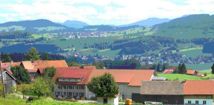
Weiler-Simmerberg is a market town in the Swabian Lindau district.
Contents
Map of Weiler-Simmerberg, Germany
Geography
Being located in the Westallgäu, the market town is bordering on the region of the Bregenz Forest, which already belongs to the Austrian administrative region of Vorarlberg. The Hausbachklamm belongs to the prominent landmarks and sights of Weiler-Simmerberg, as well as the Enschenstein and the Wildrosenmoos. Even though the landscape is rather mild, there are many very cliffy and steep rock faces due to the irregular bedding of sandstone and conglomerate.
Parts of the municipality
The area of Weiler-Simmerberg consists of the "Gemarkungen" Ellhofen, Simmerberg and Weiler im Allgäu.
The following districts belong to the market town of Weiler-Simmerberg:
History
The municipality celebrated the 1.111th anniversary of its first mentioning in 2005. The market town of Weiler-Simmerberg had been seat of a higher and lower court before 1805 and belonged to the Austrian authority of Bregenz-Hohenegg. Since the signing of the peace treaties of Brünn und Preßburg in 1805, the town belongs to Bavaria. In the course of the administrative reforms in Bavaria, the contemporary municipality was formed by the "Gemeindeedikt" of 1818.
Twin towns
Weiler-Simmerberg is twinned with: