
Existed: 1964 – present Length 8.66 km West end SR 20 near Fredonia | West end: SR 20 near Fredonia Counties: Skagit Constructed 1964 | |
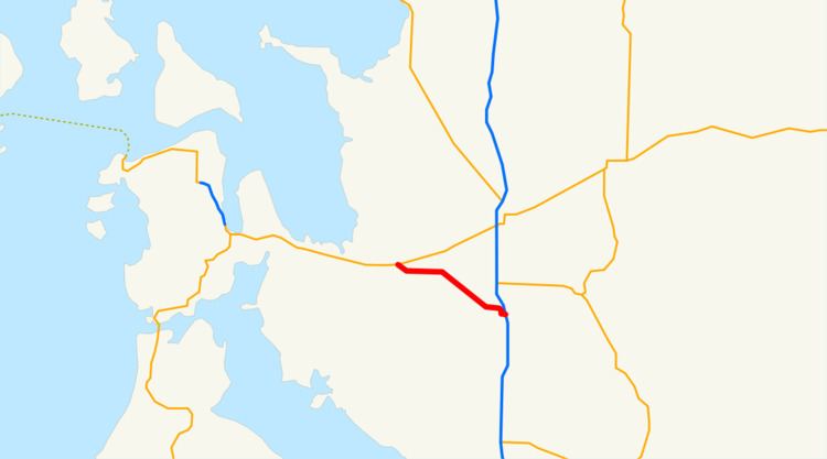 | ||
State Route 536 (SR 536) is a 5.38-mile-long (8.66 km) state highway serving Skagit County in the U.S. state of Washington. The highway travels southeast from SR 20 near Fredonia through Mount Vernon to an interchange with Interstate 5 (I-5) east of the city. SR 536 was created during the 1964 highway renumbering as a replacement for the Anacortes branch of Primary State Highway 1 (PSH 1). SR 536 was shortened to its current route in 1973 after SR 20 was extended west and a spur route was established to serve Anacortes.
Contents
Map of WA-536, Mt Vernon, WA 98273, USA
Route description
SR 536 begins as the Memorial Highway at an intersection with SR 20 located south of Skagit Regional Airport and east of Fredonia. The highway travels east through farmland before following the Skagit River southeast into Mount Vernon. SR 536 crosses the Skagit River on a swing bridge into Downtown Mount Vernon, turning east onto Division Street and south onto 3rd Street. The highway turns east at the Skagit Transportation Center onto Kincaid Street and crosses a BNSF rail line before ending at a diamond interchange with I-5.
Every year, the Washington State Department of Transportation (WSDOT) conducts a series of surveys on its highways in the state to measure traffic volume. This is expressed in terms of average annual daily traffic (AADT), which is a measure of traffic volume for any average day of the year. In 2011, WSDOT calculated that between 4,600 and 23,000 vehicles per day used the highway, mostly in Downtown Mount Vernon.
History
SR 536 was established during the 1964 highway renumbering as a 20.63-mile-long (33.20 km) highway connecting Anacortes to Mount Vernon. The highway, first codified as the Anacortes branch of PSH 1 in 1937, began at the Anacortes Ferry Terminal and traveled south to SR 525, turning east and traveling over the Swinomish Channel, leaving Fidalgo Island. SR 536 continued east to Fredonia, intersecting the termini of SR 20 and SR 537, before turning southeast over the Skagit River into Mount Vernon and ending at U.S. Route 99 (US 99). US 99 and PSH 1 were replaced by I-5 in segments between 1966 and 1970, as SR 536 was widened, paved, and extended east to a new interchange. SR 20 was extended west to Whidbey Island and the Olympic Peninsula over SR 536 and SR 525 in 1973, shortening SR 536 to its current route and creating SR 20 Spur in Anacortes. No major revisions to the route of SR 536 have occurred since 1973, however WSDOT repaved the entire roadway and added sidewalk ramps in 2009 at a cost of $3.2 million.
Major intersections
The entire highway is in Skagit County.