
Existed: 1964 – present Length 22.48 km West end Main Street in Ridgefield | Counties: Clark Constructed 1964 East end I‑5 in Ridgefield | |
 | ||
North end: Ridgefield NWR near Vancouver West end: Main Street in Ridgefield North end Ridgefield NWR near Vancouver | ||
State Route 501 (SR 501, designated as the Erwin O. Rieger Memorial Highway) is a 13.97-mile-long (22.48 km) state highway in the southern part of the U.S. state of Washington. It is split into two sections in Clark County, a north–south alignment connecting Interstate 5 (I-5) in Vancouver to the Port of Vancouver and the Ridgefield National Wildlife Refuge, and a west–east alignment connecting Ridgefield to I-5. Prior to the 1964 highway renumbering, SR 501 was designated as Secondary State Highway 1T (SSH 1T), established in 1937 and re-aligned to serve the Port of Vancouver in 1963.
Contents
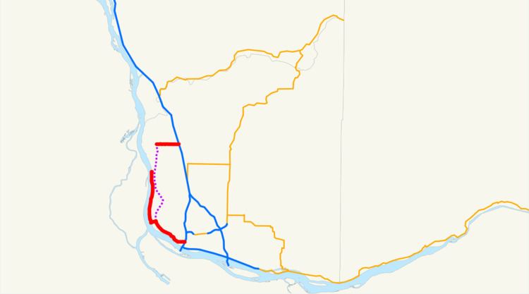
Map of WA-501, Washington, USA
Southern section
The 11.00-mile-long (17.70 km) southern section of SR 501 and the Erwin O. Rieger Memorial Highway begins as the four-lane Mill Plain Boulevard at a diamond interchange with I-5 in Downtown Vancouver. The highway travels west through Downtown Vancouver and splits into a one-way pair on 14th Street and 15th Street before rejoining as Mill Plain Boulevard. SR 501 crosses a BNSF rail yard and enters the Port of Vancouver, becoming the Lower River Road and narrowing to a two-lane highway on the south side of Vancouver Lake. The highway follows the Columbia and Lake rivers north past the Shillapoo Wildlife Recreation Area, ending south of Post Office Lake in the Ridgefield National Wildlife Refuge.
Every year, the Washington State Department of Transportation (WSDOT) conducts a series of surveys on its highways in the state to measure traffic volume. This is expressed in terms of average annual daily traffic (AADT), which is a measure of traffic volume for any average day of the year. In 2011, WSDOT calculated that the busiest section of SR 501 overall was west of I-5 at C Street, serving 13,000 vehicles, while the least busiest section of SR 501 overall was south of Shillapoo Wildlife Recreation Area, serving 650 vehicles. Between I-5 and the Port of Vancouver, SR 501 is designated as part of WSDOT's Highway of Statewide Significance, which include interstate highways and other principal arterials that are needed to connect major communities in the state of Washington.
Northern section
The 2.97-mile-long (4.78 km) northern section of SR 501 within Ridgefield begins as Pioneer Street at an intersection with Main Street at the Ridgefield City Hall. The highway travels east through Downtown Ridgefield, passing View Ridge Middle School, before crossing over Gee Creek. SR 501 continues east through two roundabouts, at 45th Street Avenue and 56th Place, before ending at a diamond interchange with I-5.
Every year, WSDOT conducts a series of surveys on its highways in the state to measure traffic volume. This is expressed in terms of AADT, which is a measure of traffic volume for any average day of the year. In 2011, WSDOT calculated that the busiest section of the northern section was the I-5 interchange, serving 11,000 vehicles, while the least busiest section was the intersection with Main Street in Downtown Ridgefield, serving 3,200 vehicles.
History
SSH 1T was created in 1937 during the formation of the primary and secondary state highways, traveling on a 18.86-mile-long (30.35 km) route north from Primary State Highway 1 (PSH 1) and U.S. Route 99 (US 99) in Vancouver through Felida and Ridgefield to PSH 1 and US 99 at Pioneer. The highway was re-aligned in 1963 to serve the Port of Vancouver, traveling along the Columbia River to Ridgefield west of Vancouver Lake onto a roadway that was to be constructed. SSH 1T became SR 501 during the 1964 highway renumbering and codified as such in 1970, being designated as the Erwin O. Rieger Memorial Highway in 1991.The highway between the Ridgefield National Wildlife Refuge and the city of Ridgefield has never been constructed and remains as a physical gap in the state highway system. The interchange between I-5 and SR 501 east of Ridgefield was rebuilt by WSDOT between 2010 and 2012, adding roundabouts at intersections west and east of the interchange as well.
Major intersections
The entire highway is in Clark County.