
Existed: 1964 – present Constructed 1965 | Length 40.52 km | |
 | ||
Counties | ||
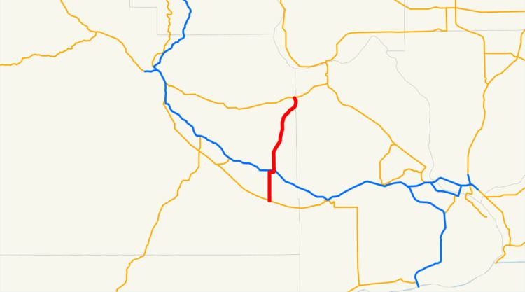
State Route 241 (SR 241) is a 25.18-mile-long (40.52 km) state highway serving Yakima and Benton counties in the U.S. state of Washington. The highway begins at SR 22 in Mabton and travels north to Sunnyside, intersecting Interstate 82 (I-82) and U.S. Route 12 (US 12) in an interchange, before entering the Rattlesnake Hills and ending at SR 24. Prior to the establishment of SR 241 in 1970, the highway between Sunnyside and the Rattlesnake Hills was designated as Secondary State Highway 3V (SSH 3V). SR 241 was moved during the construction of I-82 during the 1970s and 1980s and the roadway extended south to Mabton in 1991.
Contents
Map of WA-241, Sunnyside, WA 98944, USA
Route description
SR 241 begins as Reservation Street at an intersection with SR 22 southwest of Mabton and travels northeast across a BNSF railway into Mabton. The highway turns north onto 1st Avenue and the Sunnyside–Mabton Road, passing Round Lake and crossing the Yakima River on a 2-lane bridge. SR 241 continues into farmland before crossing over a Union Pacific rail line and the Sulphur Creek Wasteway into Sunnyside. The roadway briefly turns east onto Alexander Road and north onto Waneta Road, intersecting I-82 and US 12 in a diamond interchange. SR 241 crosses over another BNSF rail line and the Lower Yakima Valley Pathway at an intersection with the Yakima Valley Highway, the former route of US 12. The highway, now named Hanford Road, travels on the east side of Sunnyside and passes Sunnyside Municipal Airport before leaving, becoming parallel with Sulphur Creek and entering the Rattlesnake Hills. SR 241 briefly curves east into Benton County before re-entering Yakima County and ending at SR 24 west of the Hanford Reach National Monument.
Every year, the Washington State Department of Transportation (WSDOT) conducts a series of surveys on its highways in the state to measure traffic volume. This is expressed in terms of average annual daily traffic (AADT), which is a measure of traffic volume for any average day of the year. In 2011, WSDOT calculated that between 1,500 and 13,000 vehicles per day used the highway, mostly at the I-82 interchange in Sunnyside.
History
SR 241 was originally designated as SSH 3V in 1967, extending on an existing paved road from newly signed US 12 in Sunnyside to SSH 11A in the Rattlesnake Hills. The highway was signed as SR 241 in 1970 as SSH 11A became SR 24. SR 241 was extended south onto Waneta Road to an interchange with I-82 and US 12 in 1982, but an interchange with the Sunnyside–Mabton Road was considered during the planning of I-82 in the 1970s. The highway was extended further south in 1991 to SR 22 in Mabton. No major revisions to the route of the highway have occurred since.