
Congressional district At-large Area 1,800 km² Population 59,319 (2013) | Largest city Barre Founded 1810 | |
 | ||
Destinations Colleges and Universities Norwich University, Community College of Vermont, Goddard College, New England Culinary I, Vermont College of Fine Arts | ||
Washington County is a county located in the U.S. state of Vermont. Named after George Washington, its county seat is the municipality of Montpelier, the state capital. As of the 2010 census, the population was 59,534, making it the third-most populous county in Vermont, but the third-least populous capital county in the nation, after Hughes County, South Dakota and Franklin County, Kentucky. If Carson City, Nevada and Juneau Borough, Alaska are treated as counties, Washington County is the fifth-least populous capital county.
Contents
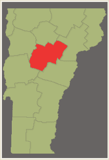
- Map of Washington County VT USA
- History
- Geography
- Major highways
- Adjacent counties
- National protected area
- 2010 census
- Cities
- Villages
- Unincorporated communities
- References
Map of Washington County, VT, USA
Washington County comprises the Barre, VT Micropolitan Statistical Area.
In 2010, the center of population of Vermont was located in Washington County, in the town of Warren.
History
Washington County is one of several Vermont counties created from land ceded by the state of New York on January 15, 1777 when Vermont declared itself to be a distinct state from New York. The land originally was contested by Massachusetts, New Hampshire, and New Netherland, but it remained undelineated until July 20, 1764 when King George III established the boundary between New Hampshire and New York along the west bank of the Connecticut River, north of Massachusetts and south of the parallel of 45 degrees north latitude. New York assigned the land gained to Albany County. On March 12, 1772 Albany County was partitioned to create Charlotte County, and this situation remained until Vermont's independence from New York and Britain.
Washington County was originally established as Jefferson County in 1810 from parts of Caledonia County, Chittenden County, and Orange County and organized the following year.
In 1814 it was renamed to Washington County. The name change occurred after the Federalists took control of the Vermont Legislature from the Jeffersonians. Vermont which conducted significant trade with British Canada had suffered particularly by passage of the Embargo Act of 1807 during the Jefferson administration.
Geography
According to the U.S. Census Bureau, the county has a total area of 695 square miles (1,800 km2), of which 687 square miles (1,780 km2) is land and 8.2 square miles (21 km2) (1.2%) is water.
Major highways
Adjacent counties
National protected area
2010 census
As of the 2010 United States Census, there were 59,534 people, 25,027 households, and 15,410 families residing in the county. The population density was 86.6 inhabitants per square mile (33.4/km2). There were 29,941 housing units at an average density of 43.6 per square mile (16.8/km2).
Of the 25,027 households, 28.2% had children under the age of 18 living with them, 47.1% were married couples living together, 10.0% had a female householder with no husband present, 38.4% were non-families, and 29.7% of all households were made up of individuals. The average household size was 2.28 and the average family size was 2.81. The median age was 42.3 years.
The median income for a household in the county was $55,313 and the median income for a family was $66,968. Males had a median income of $45,579 versus $38,052 for females. The per capita income for the county was $28,337. About 5.9% of families and 10.5% of the population were below the poverty line, including 13.8% of those under age 18 and 7.5% of those age 65 or over.