
Founded 1836 Congressional district At-large Area 1,202 km² | Population 25,067 (2013) | |
 | ||
Points of interest Lamoille River, Mount Mansfield, Smugglers' Notch State Park, Stowe Mountain Resort, Vermont Ski Museum Destinations | ||
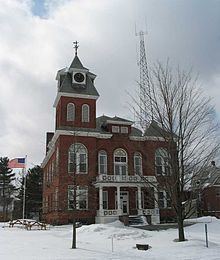
Lamoille County /ləˈmɔɪl/ is a county located in the state of Vermont, in the United States. As of the 2010 census, the population was 24,475, making it the third-least populous county in Vermont. Its shire town (county seat) is the municipality of Hyde Park. The county was created in 1835 and organized the following year.
Contents
- Map of Lamoille County VT USA
- History
- Geography
- Adjacent counties
- 2000 census
- 2010 census
- Education
- Villages
- Census designated place
- Unincorporated community
- References
Map of Lamoille County, VT, USA
History
The area was buried in a mile of ice during the ice age. When it melted partially, it created Lake Stowe. When it melted completely, the water from the lake ran out through the Lamoille River valley.
In 1972, the Lamoille Community College, along with other community colleges in Vermont, became the fifth member of the Vermont State Colleges system and was renamed Community College of Vermont.
In 2008, the state notified residents of Belvidere, Eden, Hyde Park, Johnson, Waterville and eight towns in the adjacent counties of Orleans and Franklin, that a review of health records from 1995 to 2006 had revealed that residents within ten miles (16 km) of the former asbestos mine on Belvidere Mountain had higher than normal rates of contracting asbestosis. The state and federal government continues to study this problem. In April 2009 the Vermont Department of health released a revised study which found that all of deaths related to the asbestos mine were caused by occupational exposure. The report also concluded that people living near the mines had no increased risk of asbestos related illness than people living anywhere else in Vermont.
In 2008, the county appeared to have disproportionate power in the legislature with the House Speaker, Shap Smith, from Morrisville, Floyd Nease, house majority leader, Senator Susan Bartlett, from Hyde Park, chair of the House Appropriations Committee, and Richard Westman, chair of the House Transportation Committee and the sole Republican.
Geography
According to the U.S. Census Bureau, the county has a total area of 464 square miles (1,200 km2), of which 459 square miles (1,190 km2) is land and 4.9 square miles (13 km2) (1.1%) is water. It is the second-smallest county in Vermont by area.
Lamoille County is the only county in Vermont that does not have at least one U.S. Route passing through it, although all ten of the Lamoille County towns are served by Vermont state routes.
Adjacent counties
2000 census
As of the census of 2000, there were 23,233 people, 9,221 households, and 5,984 families residing in the county. The population density was 50 people per square mile (19/km²). There were 11,009 housing units at an average density of 24 per square mile (9/km²). The racial makeup of the county was 97.31% White, 0.33% Black or African American, 0.45% Native American, 0.37% Asian, 0.03% Pacific Islander, 0.12% from other races, and 1.39% from two or more races. 0.77% of the population were Hispanic or Latino of any race. 15.7% were of English, 14.5% American, 11.9% Irish, 11.4% French, 8.7% French Canadian, 7.0% German and 5.2% Italian ancestry according to Census 2000. 95.9% spoke English and 2.4% French at home.
There were 9,221 households out of which 32.00% had children under the age of 18 living with them, 51.40% were married couples living together, 8.90% had a female householder with no husband present, and 35.10% were non-families. 25.00% of all households were made up of individuals and 8.10% had someone living alone who was 65 years of age or older. The average household size was 2.45 and the average family size was 2.94.
In the county, the population was spread out with 24.30% under the age of 18, 10.00% from 18 to 24, 29.90% from 25 to 44, 24.50% from 45 to 64, and 11.40% who were 65 years of age or older. The median age was 36 years. For every 100 females there were 100.10 males. For every 100 females age 18 and over, there were 97.30 males.
The median income for a household in the county was $39,356, and the median income for a family was $44,620. Males had a median income of $30,848 versus $24,444 for females. The per capita income for the county was $20,972. About 6.40% of families and 9.60% of the population were below the poverty line, including 10.70% of those under age 18 and 8.50% of those age 65 or over.
2010 census
As of the 2010 United States Census, there were 24,475 people, 10,014 households, and 6,274 families residing in the county. The population density was 53.3 inhabitants per square mile (20.6/km2). There were 12,969 housing units at an average density of 28.3 per square mile (10.9/km2). The racial makeup of the county was 96.7% white, 0.6% black or African American, 0.5% Asian, 0.4% American Indian, 0.3% from other races, and 1.5% from two or more races. Those of Hispanic or Latino origin made up 1.3% of the population. In terms of ancestry, 18.3% were English, 16.5% were Irish, 10.2% were German, 7.7% were French Canadian, and 4.6% were American.
Of the 10,014 households, 30.6% had children under the age of 18 living with them, 48.3% were married couples living together, 9.4% had a female householder with no husband present, 37.3% were non-families, and 27.3% of all households were made up of individuals. The average household size was 2.37 and the average family size was 2.87. The median age was 39.7 years.
The median income for a household in the county was $52,232 and the median income for a family was $62,364. Males had a median income of $41,761 versus $31,250 for females. The per capita income for the county was $27,164. About 8.7% of families and 12.0% of the population were below the poverty line, including 15.0% of those under age 18 and 8.4% of those age 65 or over.
Education
Johnson State College is a Vermont State College located in Johnson in Lamoille County. It was established in 1828 as Johnson Academy. It was among the original colleges to come together to form the Vermont State College system.
The Community College of Vermont (CCV) is located in Morrisville in Lamoille County.