
Founded 1813 Population 25,172 (2013) | Area 1,974 km² Unemployment rate 7.6% (Apr 2015) | |
 | ||
Website www.washingtoncountymo.us Rivers Big River, Little Indian Creek, Brazil Creek, Greens Creek | ||
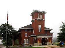
Barite tiff mining in washington county missouri built 1961
Washington County is a county located in the eastern portion of the U.S. state of Missouri. As of the 2010 census, the population was 25,195. The largest city and county seat is Potosi. The county was officially organized on August 21, 1813, and was named in honor of George Washington, the first President of the United States.
Contents
- Barite tiff mining in washington county missouri built 1961
- Map of Washington County MO USA
- Barite tiff mining in washington county missouri built 1961 enhanced
- History
- Geography
- Adjacent counties
- National protected area
- Demographics
- Religion
- Local
- State
- Federal
- Political culture
- Missouri Presidential Preference Primary 2008
- Education
- Public schools
- Private schools
- Colleges and universities
- Government and infrastructure
- 911
- Fire Departments
- Ambulance District
- Law Enforcement
- Attractions
- Primary state highways
- Airports
- Railroads
- Cities
- Villages
- References
Map of Washington County, MO, USA
Barite tiff mining in washington county missouri built 1961 enhanced
History
The French explorers Renault and La Motte entered the area of present-day Potosi in 1722-23. However, no permanent settlements were made until 1763, when François Breton settled near Potosi and began to operate a mine bearing his name. The Bellview Valley, near Caledonia and Belgrade, was settled in 1802 by the families of Annanias McCoy, Benjamin Crow, and Robert Reed. Washington County was officially organized on August 21, 1813, out of Ste. Genevieve County.
Geography
According to the U.S. Census Bureau, the county has a total area of 762 square miles (1,970 km2), of which 760 square miles (2,000 km2) is land and 2.6 square miles (6.7 km2) (0.3%) is water.
Adjacent counties
National protected area
Demographics
As of the census of 2000, there were 23,344 people, 8,406 households, and 6,237 families residing in the county. The population density was 31 people per square mile (12/km²). There were 9,894 housing units at an average density of 13 per square mile (5/km²). The racial makeup of the county was 95.47% White, 2.48% Black or African American, 0.66% Native American, 0.15% Asian, 0.01% Pacific Islander, 0.15% from other races, and 1.08% from two or more races. Approximately 0.73% of the population were Hispanic or Latino of any race.
There were 8,406 households out of which 36.40% had children under the age of 18 living with them, 58.60% were married couples living together, 10.60% had a female householder with no husband present, and 25.80% were non-families. 22.00% of all households were made up of individuals and 9.40% had someone living alone who was 65 years of age or older. The average household size was 2.64 and the average family size was 3.05.
In the county, the population was spread out with 26.60% under the age of 18, 9.80% from 18 to 24, 29.20% from 25 to 44, 22.70% from 45 to 64, and 11.70% who were 65 years of age or older. The median age was 35 years. For every 100 females there were 106.40 males. For every 100 females age 18 and over, there were 106.40 males.
The median income for a household in the county was $32,001, and the median income for a family was $38,193. Males had a median income of $27,871 versus $18,206 for females. The per capita income for the county was $16,095. About 17.10% of families and 20.80% of the population were below the poverty line, including 25.40% of those under age 18 and 12.90% of those age 65 or older.
Religion
According to the Association of Religion Data Archives County Membership Report (2000), Washington County is a part of the Bible Belt with evangelical Protestantism being the majority religion. The most predominant denominations among residents in Washington County who adhere to a religion are Roman Catholics (36.73%), Southern Baptists (21.74%), and Baptist Missionary Association of America (16.86%).
Local
The Democratic Party predominantly controls politics at the local level in Washington County. Democrats hold all but five of the elected positions in the county.
State
Washington County is divided into two legislative districts in the Missouri House of Representatives.
All of Washington County is a part of Missouri's 3rd District in the Missouri Senate and is currently represented by State Senator Kevin Engler (R-Farmington). In 2008, Engler defeated Democrat Dennis Riche 58.72-41.28 percent in the district. The 3rd Senatorial District consists of Carter, Iron, Reynolds, St. Francois, Ste. Genevieve, and Washington counties, and parts of Jefferson County.
Federal
Washington County is included in Missouri’s 8th Congressional District and is currently represented by Jason T. Smith (R-Salem) in the U.S. House of Representatives. Smith won a special election on Tuesday, June 4, 2013, to finish out the remaining term of U.S. Representative Jo Ann Emerson (R-Cape Girardeau). Emerson announced her resignation a month after being reelected with over 70 percent of the vote in the district. She resigned to become CEO of the National Rural Electric Cooperative.
Political culture
At the presidential level, Washington County is a fairly independent-leaning or battleground county although it does have a tendency to often lean Democratic. While George W. Bush carried Washington County in 2004, he narrowly lost the county to Al Gore in 2000, and both times the margins of victory were significantly closer than in many of the other rural areas. Bill Clinton also carried Washington County both times in 1992 and 1996 by convincing double-digit margins, and unlike most of the other rural counties in Missouri, Washington County was one of only nine counties in Missouri that favored Barack Obama over John McCain. Obama won Washington County by just five votes in the 2008 election.
Like most rural areas throughout Missouri, voters in Washington County generally adhere to socially and culturally conservative principles but are more moderate or populist on economic issues, typical of the Dixiecrat philosophy. In 2004, Missourians voted on a constitutional amendment to define marriage as the union between a man and a woman—it overwhelmingly passed Washington County with 81.37 percent of the vote. The initiative passed the state with 71 percent of support from voters as Missouri became the first state to ban same-sex marriage. In 2006, Missourians voted on a constitutional amendment to fund and legalize embryonic stem cell research in the state—it failed in Washington County with 56.48 percent voting against the measure. The initiative narrowly passed the state with 51 percent of support from voters as Missouri became one of the first states in the nation to approve embryonic stem cell research. Despite Washington County’s longstanding tradition of supporting socially conservative platforms, voters in the county have a penchant for advancing populist causes like increasing the minimum wage. In 2006, Missourians voted on a proposition (Proposition B) to increase the minimum wage in the state to $6.50 an hour—it passed Washington County with 81.47 percent of the vote. The proposition strongly passed every single county in Missouri with 75.94 percent voting in favor as the minimum wage was increased to $6.50 an hour in the state. During the same election, voters in five other states also strongly approved increases in the minimum wage.
Missouri Presidential Preference Primary (2008)
In the 2008 Missouri Presidential Preference Primary, voters in Washington County from both political parties supported candidates who finished in second place in the state at large and nationally.
Education
Of adults 25 years of age and older in Washington County, 62.5% possesses a high school diploma or higher while 7.5% holds a bachelor's degree or higher as their highest educational attainment.
Public schools
Private schools
Colleges and universities
Government and infrastructure
The Potosi Correctional Center of the Missouri Department of Corrections is located in an unincorporated area in the county. The prison houses male death row inmates.
911
Fire Departments
Ambulance District
Washington County Ambulance District. Administrator - Mal Gum
Law Enforcement
Washington County Sheriff's Office
Potosi Police Department
Missouri Department of Conservation
United States Forestry Service