
Elevation 310 m (1,020 ft) Population 27,302 (30 Jun 2010) Postal code 59581 | Time zone CET/CEST (UTC+1/+2) Local time Sunday 1:32 AM | |
 | ||
Weather 4°C, Wind SE at 10 km/h, 89% Humidity Points of interest Arnsberg Forest Nature P, Bilsteinhöhle, Warsteiner Welt, Bilsteintal: Tropfsteinhöhle und Wild, Möhne | ||
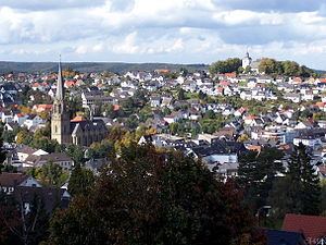
Warstein ([ˈvaːɐ̯ˌʃtaɪn]) is a town in the district of Soest, in North Rhine-Westphalia, Germany. It is located at the north end of the Sauerland.
Contents
- Map of 59581 Warstein Germany
- Geography
- Neighbouring municipalities
- Division of the town
- History
- List of mayors
- International relations
- Economy
- Literature
- References
Map of 59581 Warstein, Germany
Geography
Warstein is located north of the Arnsberger Wald (forest) at a brook called Wäster. The area south of the city is mostly forested; the lightly forested Haarstrang mountain is to the north. The river Möhne flows between these two areas. The highest elevation is 581 m (1,906 ft) in the south of the city near a hill called Stimm Stamm; the lowest elevation is 216 m (709 ft) in the village Waldhausen in the north.
Neighbouring municipalities
The following towns border Warstein (clockwise, beginning in the north): Anröchte, Rüthen, Bestwig, Meschede, Arnsberg, Möhnesee, Bad Sassendorf.
Division of the town
Warstein consists of the following 9 districts:
History
Evidence of human life was found in the Bilstein Cave between Warstein and Hirschberg. Warstein was first mentioned officially in 1072. Historians once thought Warstein was organized as an official town in 1276, but that is incorrect. It probably became a town in the same year as Belecke in 1296. In the Middle Ages Warstein was part of the Hanseatic League, that is a trade association for guilds, a very important international trading association at that time. A fire in 1802 destroyed big parts of the town. After that the town centre was moved to the Wester brook. In 1844 the Amt Warstein was founded. It was part of the Archbishopric of Cologne until 1902. In 1975 Warstein and the other eight independent villages merged to form the new borough of Warstein.
The decrease of population in Warstein since 1998:
List of mayors
International relations
Warstein is twinned with:
Economy
The largest employer in Warstein is the Warsteiner Brauerei founded in 1753. It is one of the largest breweries in Germany and is famous all over the world.