
FIPS code 06-83486 Elevation 954 m Local time Saturday 2:02 PM | Time zone Pacific (PST) (UTC-8) GNIS feature ID 251194 Zip code 92086 Area code(s) 442/760 | |
 | ||
Weather 16°C, Wind W at 32 km/h, 50% Humidity | ||
Warner Springs is a small unincorporated community in northern San Diego County, California.
Contents
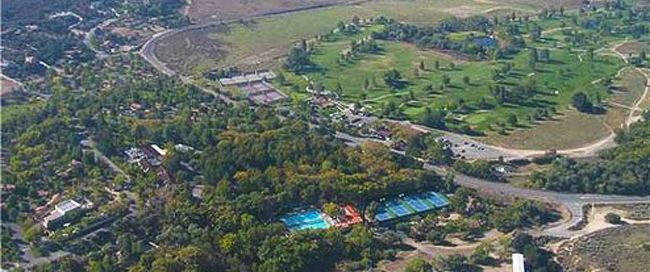
Map of Warner Springs, CA 92086, USA
Geography
The town has a post office and the ZIP code is 92086. It is near the Palomar Observatory and Warner Springs Ranch.
Warner Springs is also a popular area for gliding, due to the topography of the Peninsular Ranges in the area.
History
The Cupeño people were long time indigenous inhabitants of the Warner Springs area. The Cupeño/Cahuilla Agua Caliente rancheria village was located at the hot springs (Spanish: agua caliente) located here.
The hot springs were "rediscovered" by Spanish explorers of upper Las Californias province in 1795.
19th century
The Santa Ysabel Asistencia (satellite mission) was founded c. 8 miles (13 km) to the south of the Agua Caliente springs in 1818 by Spanish missionaries originating from Mission San Diego de Alcalá.
St Francis Mission chapel was erected near the settlement c. 1830. Its walls use adobe mud bricks, white-washed over and a roof incorporating locally made red tiles. A stone bell tower is placed next to the southern wall of the church.
Warner's Ranch
Juan Jose Warner received the 26,689-acre (108.01 km2) Rancho San Jose del Valle Mexican land grant in 1844, and renamed the area Warner Springs. Also in 1844, the asistencia's lands on the south became part of the Rancho Santa Ysabel Mexican land grant. In 1851 the Cupeño/Cahuilla "Garra_Revolt" raid on Warner's Ranch occurred, a part of the Yuma War against immigrant intrusions.
The Warner's Ranch adobe complex of Juan Jose Warner was a way station for large numbers of emigrants on the Southern Emigrant Trail from 1849 to 1861, as it was a stop on the Southern Emigrant–Gila River Trail. He opened the only trading post that served travelers on the trail between New Mexico Territory and the Pueblo de Los Angeles in Alta California. It later became a stop on the San Antonio-San Diego Mail Line in 1857, and the Oak Grove Butterfield Stage Station stop on the Butterfield Overland Mail stagecoach line (1857–1861).
At the start of the Civil War in 1861, stagecoach service was discontinued and the Union Army established Camp Wright, a cavalry outpost at the ranch to protect the route from Southern California to Fort Yuma, and to intercept secessionist sympathizers attempting to the join the Confederate armies in the American South and in the Arizona Territory.
Former California Governor John Downey purchased the Warner Springs Ranch in 1880, to graze cattle and sheep herds. In 1892, after years of disputes with the Cupeños living at the ranch, Downey sued to evict the Indians. In 1894 after Downey's death, the U.S. Supreme Court ruled against the Cupeños. The eviction order came in 1901 and their exodus two years later became known as the “Cupeno Trail of Tears.”
20th century
William Henshaw purchased the Warner Springs Ranch in 1911, and had Henshaw Dam completed by latter 1922 and its reservoir filled by 1924. In 1978 the reservoir level was lowered 40% due to danger from the Elsinore Fault Zone running beneath the dam.
Several Warner Spring sites and buildings were designated California Historical Landmarks (CHL), &/or National Historic Landmarks (NHL), &/or listed on the National Register of Historic Places (NRHP) – in the 20th century.