
 | ||
Wansdyke (from Woden's Dyke) is a series of early medieval defensive linear earthworks in the West Country of England, consisting of a ditch and a running embankment from the ditch spoil, with the ditching facing north. There are two main parts: an eastern dyke which runs between Savernake Forest and Morgan's Hill in Wiltshire, and a western dyke which runs from Monkton Combe to the ancient hill fort of Maes Knoll in historic Somerset. Between these two dykes there is a middle section formed by the remains of the London to Bath Roman road. There is also some evidence in charters that it extended west from Maes Knoll to the coast of the Severn Estuary but this is uncertain. It may possibly define a post-Roman boundary.
Contents
Usage and dating
Wansdyke consists of two sections, 14 and 19 kilometres (9 and 12 mi) long with some gaps in between. East Wansdyke is an impressive linear earthwork, consisting of a ditch and bank running approximately east-west, between Savernake Forest and Morgan's Hill. West Wansdyke is also a linear earthwork, running from Monkton Combe south of Bath to Maes Knoll south of Bristol, but less impressive than its eastern counterpart. The middle section, 22 kilometres (14 mi) long, is sometimes referred to as 'Mid Wansdyke', but is formed by the remains of the London to Bath Roman road. It used to be thought that these sections were all part of one continuous undertaking, especially during the Middle Ages when the pagan name Wansdyke was applied to all three parts. However, it is not now considered certain that this is so.
East Wansdyke
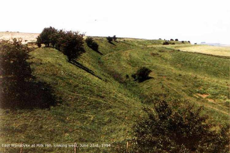
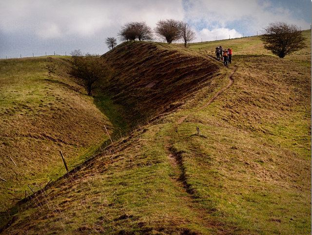
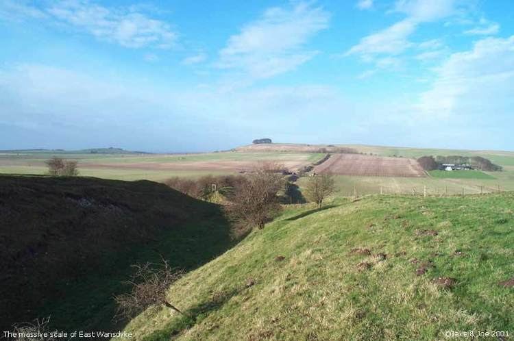
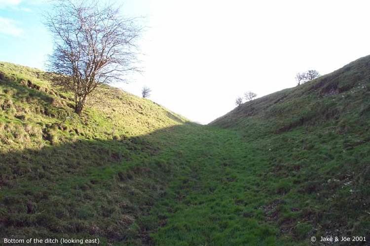
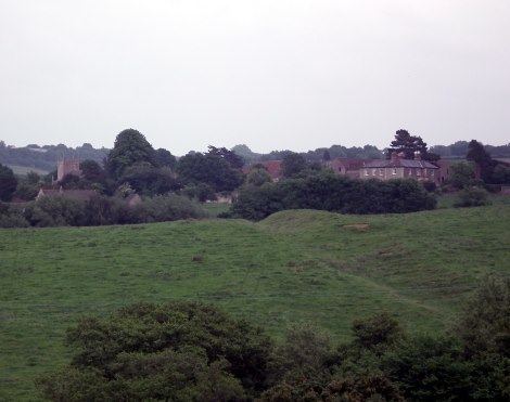
East Wansdyke in Wiltshire, on the south of the Marlborough Downs, has been less disturbed by later agriculture and building. It is more clearly traceable on the ground than the western part. In places the bank is up to 4 m (13 ft) high and the ditch as much as 2.5 m (8.2 ft) deep. Since at least the tenth century there have been gaps, "gates", in the work. Fowler suggests that its plan is consistent with those of Roman border fortifications such as Hadrian's Wall, not just a military defence but intended to control locals and travelers along the Wessex Ridgeway. He suggests further that the works were never finished, abandoned in the face of a political change which removed their rationale. Wansdyke's origins are unclear, but the eastern part was probably built during the 5th or 6th century. That is, after the withdrawal of the Romans, and before the arrival of the Anglo-Saxons. The earthwork is named after Woden, indicating that the incoming Anglo-Saxons had no information about the origins of a structure that was there when they arrived, and which was of no significance to locals at that time.
The ditch is on the north side, so Wansdyke may have been intended by the Romano-Britons as a defence against West Saxons encroaching from the upper Thames Valley westward into what is now the West Country. Lieut.-General Augustus Pitt Rivers carried out excavations at the Wansdyke in Wiltshire in the late 19th century, considering it the remains of a great war in which the southwest was being defended. In 1958, Fox and Fox attributed its construction to the pagan Saxons, probably in the late sixth century. Its relationship to the expansion of the West Saxons was considered in 1964 by J.N.L. Myres, who maintained that Wansdyke was constructed by some sub-Roman authority. Fowler speculates that it was a fortification intended for use against invading Saxons in the 490s, and abandoned when the news of British victory at Mons Badonicus made it redundant.
West Wansdyke
Although the antiquarians like John Collinson considered West Wansdyke to stretch from Bathampton Down south east of Bath, to the west of Maes Knoll, a review in 1960 considered that there was no evidence of its existence to the west of Maes Knoll. Keith Gardner refuted this with newly discovered documentary evidence. In 2007 a series of sections were dug across the earthwork which showed that it had existed where there are no longer visible surface remains. It was shown that the earthwork had a consistent design, with stone or timber revetment. There was little dating evidence but it was consistent with either a late Roman or post-Roman date. A paper in "The Last of the Britons" conference in 2007 suggests that the West Wansdyke continues from Maes Knoll to the hill forts above the Avon Gorge and controls the crossings of the river at Saltford and Bristol as well as at Bath.
As there is little archaeological evidence to date the western Wansdyke, it may have marked a division between British Celtic kingdoms or have been a boundary with the Saxons. The evidence for its western extension is earthworks along the north side of Dundry Hill, its mention in a charter and a road name.
The area of the western Wansdyke became the border between the Romano-British Celts and the West Saxons following the Battle of Deorham in 577 AD. According to the Anglo-Saxon Chronicle, the Saxon Cenwalh achieved a breakthrough against the Britons, with victories at Bradford on Avon (in the Avon Gap in the Wansdyke) in 652 AD, and further south at the Battle of Peonnum (at Penselwood) in 658 AD, followed by an advance west through the Polden Hills to the River Parrett. It is however significant to note that the names of the early Wessex kings appear to have a Brythonic (British) rather than Germanic (Saxon) etymology.
A 1,330 yards (1,220 m) section of Wansdyke in Odd Down, which has been designated as an Ancient monument, appears on the Heritage at Risk register as being in unsatisfactory condition and vulnerable due to gardening.
Nomenclature
The Saxons named the dyke after their god Wōden, hence it became 'Woden's Dyke' and, eventually, Wansdyke. Its name occurs in charters of the 9th and 10th century AD. It may be compared to both Offa's Dyke (later, and forming a Mercian border with Wales) and Hadrian's Wall (earlier and forming a border between Britannia & Caledonia) as one of the largest defensive earthworks in the United Kingdom. Nennius, an 8th-century Welsh monk who had access to older chronicles since lost, describes these defences and their purpose, and links them to the legends of King Arthur.
Modern use of name
The Western Wansdyke gave its name to the former Wansdyke district of the county of Avon, and also to the Wansdyke constituency. It is now in Bath and North East Somerset unitary authority.