
 | ||
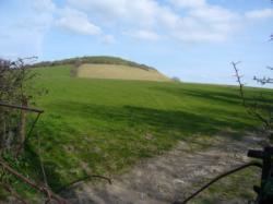
The Polden Hills in Somerset, England are a long, low ridge, extending for 10 miles (16 km), and separated from the Mendip Hills, to which they are nearly parallel, by a marshy tract, known as the Somerset Levels. They are now bisected at their western end by the M5 motorway and a railway, the Bristol and Exeter Railway, part of the Great Western Main Line.
Contents
- Woolavington cossington polden hills churches june 2011 0001
- Location and history
- Geology and ecology
- Centres of population
- Villages of the Polden Hills west to east
- References
Woolavington cossington polden hills churches june 2011 0001
Location and history
The hills stretch from Puriton, near Bridgwater, in the west, to Street, in the east. The ridge of the hill once accommodated a Roman road, from Ilchester to the port of Combwich. Roman and Iron Age objects from the "Polden Hill Hoard" are now in the British Museum. This road crossed the River Parrett by means of a ford, at the White House (White House Rhyne), on the Pawlett Hams. This western extension forms part of a Saxon route. The river crossing could only be used a few hours per day at low tide and was used by Samuel Taylor Coleridge in the 1790s when he stayed at Nether Stowey, to travel to and from Bristol. It went out of use as other roads were improved and the White House, a former public house, is now just a ruin. The modern road, now the A39, is carried on a causeway from the King's Sedgemoor Drain, at Bawdrip, to Bridgwater.
Geology and ecology
The Poldens are a low narrow ridge of Blue Lias with alternating bands of limestone and clay. Blue Lias is believed to have been quarried on the Polden Hills in the 15th century; and was quarried in Puriton from the early 19th century until the 1973, when the local cement works closed.
Great Breach and Copley Woods near Compton Dundon is a Nature Conservation Review Woodland Site, owned and managed by the Somerset Wildlife Trust. It has been designated as a biological Site of Special Scientific Interest because of the invertebrate population.
Centres of population
The former medieval planned town of Caput Montis was located at the western end of the Polden Hills. Caput Montis failed as a planned town and now exists as the earth works of a Motte and Bailey in the hamlet of Downend, now a detached part of the village of Puriton. There was also at Dunball a railway Halt, a Hotel, a Post Office and a Wharf - part of the Port of Bridgwater.
There are a number of small villages situated on both slopes of the ridge, many of which are named in the Domesday Book. Most of the eastern villages, from Street to Cossington, and possibly Woolavington, (which are also parishes) are located in medieval planned-parishes. They once formed parts of the Estates of Glastonbury Abbey.
Villages of the Polden Hills (west to east)
Puriton - Bawdrip - Woolavington - Cossington - Stawell - Chilton Polden - Edington - Catcott - Shapwick - Ashcott - Walton - Street