
Primary inflows Area 50 ha Water volume 880,200 m³ | Catchment area 5.8 km² | |
 | ||
Surface area 50 hectares (120 acres) Average depth 1.7 metres (5 ft 7 in) (AHD) Similar Terrigal Lagoon, Tuggerah Lake, Karuah River, Minnamurra River, Cudgegong River | ||
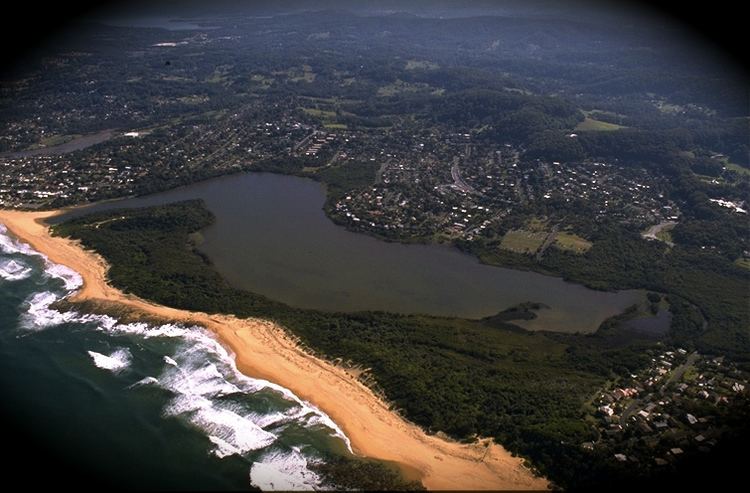
Wamberal Lagoon, an intermittently closed intermediate saline coastal lagoon, is located on the Central Coast region of New South Wales, Australia. Wamberal Lagoon is located between the beachside settlements of Forresters Beach and Wamberal, and adjacent to the east coast, about 87 kilometres (54 mi) north of Sydney.
Contents
Map of Wamberal Lagoon, Wamberal NSW 2260, Australia
Features and locationEdit
Fed by stormwater runoff that flows into Forresters Creek, the lagoon has a surface area of approximately 50 hectares (120 acres) and a catchment area of 5.8 square kilometres (2.2 sq mi). When full, the Wamberal Lagoon covers an area of around 50 hectares (120 acres). Its outflow is to the Tasman Sea of the South Pacific Ocean that is generally closed, and water levels inside the lagoon are not usually influenced by ocean tides.
The lagoon and the surrounding land comprising 139 hectares (340 acres) form part of the Wamberal Lagoon Nature Reserve, a nature reserve created in 1981, that is under management of the NSW National Parks & Wildlife Service.
Terrigal Lagoon and Avoca Lake are located to the south and are a short distance away.