
- elevation 766 m (2,513 ft) - elevation 341 m (1,119 ft) | ||
 | ||
Similar Windamere Dam, Burrendong Dam, Terrigal Lagoon, Brogo River, Wamberal Lagoon | ||
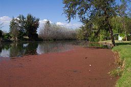
Cudgegong River, a perennial stream that is part of the Macquarie catchment within the Murray-Darling basin, is located in the central western and Orana districts of New South Wales, Australia.
Map of Cudgegong River, New South Wales, Australia
The river rises of the western slopes of the Great Dividing Range within Wollemi National Park, east of Rylstone, and flows generally west, north-west, and south-west, joined by fourteen tributaries, including Wyaldra Creek and Lawsons Creek, before reaching its confluence with the Macquarie River at Lake Burrendong; descending 425 metres (1,394 ft) over its 250-kilometre (160 mi) course.
Several reservoirs, including Rylstone Reservoir and Lake Windamere, impede the natural flow of the Cudgegong River past the towns of Mudgee, and near Gulgong.
References
Cudgegong River Wikipedia(Text) CC BY-SA