
Country United States Incorporated February 21, 1798 Population 41 (2000) | Earliest mention October 26, 1731 ZIP code 07881 - Walpack Center Local time Saturday 5:06 AM | |
 | ||
Area rank 109th of 566 in state10th of 24 in county Weather 2°C, Wind NW at 13 km/h, 53% Humidity | ||
Walpack Township is a township in Sussex County, New Jersey, United States. As of the 2010 United States Census, the township had a population of 16, reflecting a decline of 25 (-61.0%) from the 41 counted in the 2000 Census, which had in turn declined by 26 (-38.8%) from the 67 counted in the 1990 Census. Walpack Township was one of only four municipalities in New Jersey with a double-digit population as of the 2010 Census, and it placed third behind Tavistock (population 5) and Pine Valley (population 12), both in Camden County.
Contents
- Map of Walpack Township NJ USA
- History
- Geography
- Census 2010
- Census 2000
- Local government
- Federal state and county representation
- Politics
- Education
- Transportation
- Notable people
- References
Map of Walpack Township, NJ, USA
Walpack Township dates back to October 26, 1731, when it was first mentioned as Walpake in Hunterdon County. The area covered by the present-day township was set off to Morris County upon that county's creation in 1739, and became part of the newly formed Sussex County in 1753. As of April 15, 1754, Walpack's boundaries were defined as a "precinct". Walpack was formally incorporated as a township by an act of the New Jersey Legislature on February 21, 1798. Portions of the township were taken to form Montague Township (March 26, 1759), Sandyston Township (February 26, 1762) and the now-defunct Pahaquarry Township in Warren County (December 27, 1824). Territory was gained from Stillwater Township in 1935.
The current Walpack Township is named from a corruption of the Lenape Native American content word "wahlpeck," which means "turn-hole," or an eddy or whirlpool, a compound of two Native American words, "woa-lac" (a hole), and "tuppeck" (a pool), though other sources attribute the name to mean "very deep water" or "sudden bend of a stream around the base of a rock".
New Jersey Monthly magazine ranked Walpack Township as its 18th best place to live in its 2008 rankings of the "Best Places To Live" in New Jersey.
History
The Andrew Snable House was built in 1801 and was added to the National Register of Historic Places on July 23, 1979.
Geography
According to the United States Census Bureau, the township had a total area of 24.702 square miles (63.979 km2), including 24.050 square miles (62.289 km2) of land and 0.652 square miles (1.689 km2) of water (2.64%). The township is located in the Minisink Valley that extends from the Delaware Water Gap north to Port Jervis, New York.
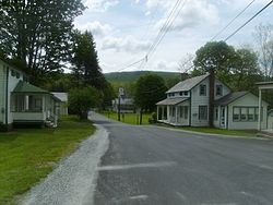
Unincorporated communities, localities and place names located partially or completely within the township include Dry Pond, Flat Brook, Flatbrookville, Haneys Mill, Harding Lake, Long Pond and Walpack Center.
Census 2010
As of the census of 2010, there were 16 people, 8 households, and 4 families residing in the township. The population density was 0.7 per square mile (0.27/km2). There were 15 housing units at an average density of 0.6 per square mile (0.23/km2). The racial makeup of the township was 93.75% (15) White, 0.00% (0) Black or African American, 0.00% (0) Native American, 0.00% (0) Asian, 0.00% (0) Pacific Islander, 0.00% (0) from other races, and 6.25% (1) from two or more races. Hispanic or Latino of any race were 0.00% (0) of the population.
There were 8 households out of which 12.5% had children under the age of 18 living with them, 37.5% were married couples living together, 0.0% had a female householder with no husband present, and 50.0% were non-families. 50.0% of all households were made up of individuals, and 25.0% had someone living alone who was 65 years of age or older. The average household size was 2.00 and the average family size was 3.00.
In the township, the population was spread out with 12.5% under the age of 18, 12.5% from 18 to 24, 18.8% from 25 to 44, 31.3% from 45 to 64, and 25.0% who were 65 years of age or older. The median age was 56.5 years. For every 100 females there were 100.0 males. For every 100 females ages 18 and old there were 100.0 males.
The Census Bureau's 2006-2010 American Community Survey showed that (in 2010 inflation-adjusted dollars) median household income was $108,333 (with a margin of error of +/- $155,555) and the median family income was $127,500 (+/- $88,897). Males had a median income of $ (+/- $) versus $57,813 (+/- $26,023) for females. The per capita income for the borough was $36,663 (+/- $14,435). About 0.0% of families and 0.0% of the population were below the poverty line, including 0.0% of those under age 18 and 0.0% of those age 65 or over.
Census 2000
As of the 2000 United States Census there were 41 people, 20 households, and 12 families residing in the township. The population density was 1.7 people per square mile (0.7/km²). There were 34 housing units at an average density of 1.4 per square mile (0.5/km²). The racial makeup of the township was 100.00% White.
There were 20 households out of which 20.0% had children under the age of 18 living with them, 50.0% were married couples living together, 10.0% had a female householder with no husband present, and 40.0% were non-families. 40.0% of all households were made up of individuals and 10.0% had someone living alone who was 65 years of age or older. The average household size was 2.05 and the average family size was 2.75.
In the township the population was spread out with 19.5% under the age of 18, 2.4% from 18 to 24, 19.5% from 25 to 44, 31.7% from 45 to 64, and 26.8% who were 65 years of age or older. The median age was 49 years. For every 100 females there were 95.2 males. For every 100 females age 18 and over, there were 106.3 males.
The median income for a household in the township was $22,250, and the median income for a family was $22,250. Males had a median income of $46,250 versus $0 for females. The per capita income for the township was $17,624. None of the population and none of the families were below the poverty line.
Local government
Walpack Township is governed under the Township form of government. The governing body is a three-member Township Committee, whose members are elected directly by the voters at-large in partisan elections to serve three-year terms of office on a staggered basis, with one seat coming up for election each year as part of the November general election in a three-year cycle. At an annual reorganization meeting, the Township Committee selects one of its members to serve as Mayor and another as Deputy Mayor.
As of 2016, members of the Walpack Township Committee are Mayor Victor J. Maglio (R, term on committee ends December 31, 2017; term as mayor ends 2016), Deputy Mayor James Heigis (R, term on committee ends 2018; term as deputy mayor ends 2016) and Janina Wycalek (D, 2016).
Federal, state and county representation
Walpack Township is located in the 5th Congressional District and is part of New Jersey's 24th state legislative district.
New Jersey's Fifth Congressional District is represented by Josh Gottheimer (D, Wyckoff). New Jersey is represented in the United States Senate by Cory Booker (D, Newark, term ends 2021) and Bob Menendez (D, Paramus, 2019).
For the 2016–2017 session (Senate, General Assembly), the 24th Legislative District of the New Jersey Legislature is represented in the State Senate by Steve Oroho (R, Franklin) and in the General Assembly by Parker Space (R, Wantage Township) and Gail Phoebus (R, Andover Township). The Governor of New Jersey is Chris Christie (R, Mendham Township). The Lieutenant Governor of New Jersey is Kim Guadagno (R, Monmouth Beach).
Sussex County is governed by a Board of Chosen Freeholders whose five members are elected at-large in partisan elections on a staggered basis, with either one or two seats coming up for election each year. At an annual reorganization meeting held in the beginning of January, the board selects a Freeholder Director and Deputy Director from among its members, with day-to-day supervision of the operation of the county delegated to a County Administrator. As of 2014, Sussex County's Freeholders are Freeholder Director Richard Vohden (R, Green Township, 2016), Deputy Director Dennis J. Mudrick (R, Sparta Township, 2015), Phillip R. Crabb (R, Franklin, 2014), George Graham (R, Stanhope, 2016) and Gail Phoebus (R, Andover Township, 2015). Graham was chosen in April 2013 to fill the seat vacated by Parker Space, who had been chosen to fill a vacancy in the New Jersey General Assembly. Constitutional officers elected on a countywide basis are County Clerk Jeff Parrott (R, 2016), Sheriff Michael F. Strada (R, 2016) and Surrogate Gary R. Chiusano (R, filling the vacancy after the resignation of Nancy Fitzgibbons). The County Administrator is John Eskilson.
Politics
As of March 23, 2011, there were a total of 22 registered voters in Walpack Township, of which 1 (4.5% vs. 16.5% countywide) were registered as Democrats, 17 (77.3% vs. 39.3%) were registered as Republicans and 2 (9.1% vs. 44.1%) were registered as Unaffiliated. There were 2 voters registered to other parties. Among the township's 2010 Census population, 137.5% (vs. 65.8% in Sussex County) were registered to vote, including 157.1% of those ages 18 and over (vs. 86.5% countywide).
In the 2012 presidential election, Republican Mitt Romney received 10 votes (83.3% vs. 59.4% countywide), ahead of Democrat Barack Obama with 2 votes (16.7% vs. 38.2%) and other candidates with no votes (0.0% vs. 2.1%), among the 12 ballots cast by the township's 18 registered voters, for a turnout of 66.7% (vs. 68.3% in Sussex County). In the 2008 presidential election, Republican John McCain received 14 votes (70.0% vs. 59.2% countywide), ahead of Democrat Barack Obama with 3 votes (15.0% vs. 38.7%) and other candidates with 2 votes (10.0% vs. 1.5%), among the 20 ballots cast by the township's 28 registered voters, for a turnout of 71.4% (vs. 76.9% in Sussex County). In the 2004 presidential election, Republican George W. Bush received 22 votes (78.6% vs. 63.9% countywide), ahead of Democrat John Kerry with 6 votes (21.4% vs. 34.4%) and other candidates with no votes (0.0% vs. 1.3%), among the 28 ballots cast by the township's 35 registered voters, for a turnout of 80.0% (vs. 77.7% in the whole county).
In the 2013 gubernatorial election, Republican Chris Christie received 77.8% of the vote (7 cast), ahead of Democrat Barbara Buono with 22.2% (2 votes), and other candidates receiving no votes, among the 9 ballots cast by the township's 19 registered voters, for a turnout of 47.4%. In the 2009 gubernatorial election, Republican Chris Christie received 11 votes (91.7% vs. 63.3% countywide), ahead of Democrat Jon Corzine with one vote (8.3% vs. 25.7%), Independent Chris Daggett with no votes (0.0% vs. 9.1%) and other candidates with no votes (0.0% vs. 1.3%), among the 12 ballots cast by the township's 23 registered voters, yielding a 52.2% turnout (vs. 52.3% in the county).
Education
Students in kindergarten through sixth grade attend the schools of the Sandyston-Walpack Consolidated School District, together with students from Sandyston Township. The school is located in Layton. As of the 2013-14 school year, the district's one school had an enrollment of 148 students and 17.3 classroom teachers (on an FTE basis), for a student–teacher ratio of 8.5:1.
Students in seventh through twelfth grade for public school attend Kittatinny Regional High School located in Hampton Township, which also serves students who reside in Fredon Township, Hampton Township, Stillwater Township and Sandyston Township. The high school is located on a 96-acre (39 ha) campus in Hampton Township, about seven minutes outside of the county seat of Newton. As of the 2014-15 school year, the high school had an enrollment of 1,079 students and 97.0 classroom teachers (on an FTE basis), for a student–teacher ratio of 11.1:1. Kittatinny Regional High School was recognized as a National Blue Ribbon School of Excellence in 1997-98.
Transportation
As of May 2010, the township had a total of 20.01 miles (32.20 km) of roadways, all of which were maintained by the municipality.
Notable people
People who were born in, residents of, or otherwise closely associated with Walpack Township include: