
- summer (DST) CEST (UTC+2) Local time Wednesday 12:59 PM | Area 379.9 km² | |
 | ||
Weather 8°C, Wind E at 13 km/h, 75% Humidity Neighborhoods Points of interest High Tatras, Lomnický štít, Gerlachovský štít, Štrbské pleso, Belianska Cave | ||
Slovakia vysok tatry high tatras
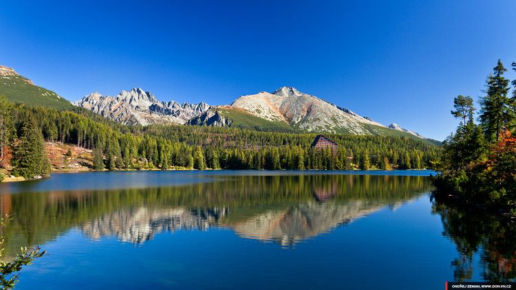
Vysoké Tatry (literally, High Tatras), informally Mesto Vysoké Tatry (literally, The Town of High Tatras), is a town at the feet of the Slovak part of High Tatras in Slovakia including all the major resorts in that region. It was created in 1990, and its official name from 1990 to 1999 was Starý Smokovec, which is the name of one of its major settlements.
Contents
- Slovakia vysok tatry high tatras
- Map of VysokC3A9 Tatry Slovakia
- Vysok tatry 2017 high tatras slovakia gopro hero5
- Features and statistics
- Administrative division
- History
- Demographics
- Sport
- Notable people
- Twin towns Sister cities
- References
Map of Vysok%C3%A9 Tatry, Slovakia
Vysok tatry 2017 high tatras slovakia gopro hero5
Features and statistics
The town of Vysoké Tatry is special in many respects. It is not a true town, but a conglomerate of separate and different settlements (originally separate villages), whose only common feature is that they are the main tourist resorts in the Slovak High Tatras, while being connected through a common railway network (the Tatra Railway). After the country's capital, the town is Slovakia's major tourist destination. On December 31, 2004, it had 4953 inhabitants, excluding tourists. It is located at an elevation of 1,010 m (3,310 ft) above sea level. Covering 380.216 square kilometres (146.8 square miles), it is Slovakia's largest urban area.
The local authority, cultural centre, and main shops are located in the settlement of Starý Smokovec.
Administrative division
The town consists of three cadastral areas, which consist of 14 settlements:
History
The present-day town was created in 1990 and has a complicated administrative history.
The municipality (that is, not a town) of Vysoké Tatry was created as early as 1947 on the territory of the following formerly distinct municipalities: Batizovce, Huncovce, Folvarky, Gerlachov, Kežmarok, Liptovská Kokava, Mlynica, Nová Lesná, Malý Slavkov, Mengusovce,výbor Vysoké Tatry" - literally, "The United National Committee of High Tatras", 'national committee' being the term then used to designate local authorities in Czechoslovakia).
In 1954, parts of the municipalities Pribylina (the majority of which was returned in 2004), Východná, and Liptovská Kokava were added to Vysoké Tatry. Starý Smokovec was made the seat of the Vysoké Tatry municipality.
In 1960, the Vysoké Tatry municipality ceased to exist and was divided into the following separate municipalities: Starý Smokovec (enhanced with town status), Štrbské Pleso, Tatranská Lomnica, Ždiar, and Štôla. However, since 1964 these municipalities had again a common local authority, although they remained distinct municipalities.
In 1990, three of the above municipalities - Starý Smokovec, Štrbské pleso and Tatranská Lomnica - were merged to create the town of 'Starý Smokovec'(named after the settlement serving as the seat of the authorities). The remaining municipalities - Ždiar and Štôla - are still independent municipalities.
In 1999, the town of 'Starý Smokovec' was renamed 'Vysoké Tatry'.
Demographics
On 31 December 2006, Vysoké Tatry had a population of 4,718. According to the 2001 census, 92.95% of inhabitants were Slovaks, 2.22% Czechs, 0.57% Hungarians, 0.26% Germans, and 0.17% Rusyns. The religious make-up was as follows: 61.96% Roman Catholics, 18.96% people with no religious affiliation, 7.64% Lutherans, and 3.62% Greek Catholics.
Sport
In 1935 and 1970 the area hosted the FIS Nordic World Ski Championships. The area was scheduled to host the 17th Winter Deaflympics, but the event was cancelled because of the lack of readiness by the Slovakian Deaflympic Organizing Committee to host the games.
Notable people
Twin towns — Sister cities
Vysoké Tatry is twinned with: