
Existed: early 1980s – present Length 2.88 km | County Alexandria | |
 | ||
North end: George Washington Parkway in Alexandria | ||
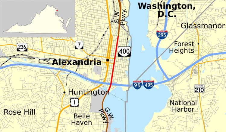
State Route 400 (SR 400) is a primary state highway in the U.S. state of Virginia. Locally known as Washington Street, the state highway runs 1.79 miles (2.88 km) from the south city limit of the independent city of Alexandria north to 1st Street, still within Alexandria. SR 400 is a city street connection through Old Town Alexandria between the two segments of George Washington Memorial Parkway, one heading south toward Mount Vernon and one heading north toward Washington. The Virginia Department of Transportation assigned the unsigned SR 90005 designation to the two segments of the parkway and SR 400.
Contents
Map of VA-400, Alexandria, VA, USA
Route description
SR 400 begins at the south city limit of Alexandria at Hunting Creek. The highway continues south into Fairfax County and Belle Haven as the George Washington Memorial Parkway toward Mount Vernon. SR 400 is a four-lane divided highway through the Jones Point neighborhood before becoming undivided and crossing over the Capital Beltway (I-95 and I-495) on a freeway cap, a very wide overpass that shields the freeway from view of the crossing highway, between the Woodrow Wilson Bridge over the Potomac River and the Capital Beltway's interchange with U.S. Route 1 (US 1). The first intersection north of the bridge is with Church Street, which receives a ramp from the westbound Capital Beltway. SR 400 continues through Old Town Alexandria with six lanes and passes the Davis Chapel. The state highway meets the eastern ends of SR 236 (Duke Street) and SR 7 (King Street) in the Alexandria Historic District, where the Lyceum and Beulah Baptist Church line the southbound side of the street and the statue Appomattox lies in the middle of the street at its intersection with Prince Street. SR 400 continues north past the Christ Church, the Lloyd House, and the Lee-Fendall House to its northern terminus at First Street. George Washington Memorial Parkway resumes at this intersection and continues toward Arlington and Washington.
History
Most of SR 400, from Franklin Street to Powhatan Street, was once part of US 1, and the present alignment (roughly) of US 1 was then US 1 Truck.
Major intersections
The entire route is in Alexandria.