
Country United States of America Elevation 7,946 ft (2,422 m) | Peak Virgin Peak Area 116 sq mi (300 km2) | |
 | ||
Similar Mormon Mountains, Virgin River Gorge, Muddy Mountains, Mount Bangs, Virgin River | ||
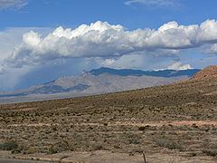
The Virgin Mountains are a mountain range of the northeastern Mojave Desert, located in Clark County, southeastern Nevada and Mohave County, northwestern Arizona.
Contents
Map of Virgin Mountains, Nevada 89007, USA
GeographyEdit
Virgin Peak, at 7,946 feet (2,422 m) in elevation, is the highest point in the range. The range is northeast of Lake Mead, and around 15 miles (24 km) south of the Nevada town of Mesquite.
Hydrologically, the range is located in the Lower Colorado—Lake Mead watershed. (USGS Huc 1501),
91.6% of the range is managed by the Bureau of Land Management, with a section of the Virgin Peak area designated within the BLM Virgin Mountain Natural Area.
Natural historyEdit
The range has many species of lizards, as well as the Panamint rattlesnake and glossy snake. Trees found in the range include Single-leaf pinyon pine (Pinus monophylla), Arizona cypress (Cupressus arizonica), White fir (Abies concolor), Douglas fir (Pseudotsuga menziesii), and Utah juniper (Juniperus osteosperma), and Rocky Mountain juniper (Juniperus scopulorum).