
Region Montréal Provincial Laurier-DorionViau Local time Monday 11:50 AM | Established January 01, 2002 Population 142,222 (2011) | |
 | ||
Electoral DistrictsFederal PapineauSaint-Léonard—Saint-MichelAhuntsic-Cartierville Weather 4°C, Wind SW at 3 km/h, 43% Humidity Points of interest Jarry Park, Saint‑Michel Environnemental Complex, Cirque du Soleil | ||
Villeray–Saint-Michel–Parc-Extension is a borough (arrondissement) in the city of Montreal, Quebec. It had a population of 142,222 according to the 2011 Census and a land area of 16.5 square kilometres (6.4 sq mi).
Contents
- Map of VillerayE28094Saint MichelE28094Parc Extension MontrC3A9al QC Canada
- History
- Geography
- Municipal
- Borough council
- Federal and provincial
- Demographics
- Features
- Education
- References
Map of Villeray%E2%80%94Saint-Michel%E2%80%94Parc-Extension, Montr%C3%A9al, QC, Canada
The borough of Villeray–Saint-Michel–Parc-Extension was created on January 1, 2002, following the municipal reorganization of Montreal. The borough includes the neighbourhoods of Villeray, Saint-Michel, and Parc-Extension.
History
Until the late Nineteenth century, the area that today comprises the borough of Villeray–Saint-Michel–Parc-Extension was predominately rural and dotted with farms. The inauguration of the Canadian Pacific Railway in 1878 and the arrival of electric streetcars in 1892 permitted the growth of Villeray. It was also in this era that the Italian immigrant community chose the neighbourhood as their preferred location.
In the early Twentieth century, Park Extension became industrialized, and a dozen quarries opened which led to the economic development of the area. Beginning in the 1940s, the exploitation of the Miron and Francon quarries attracted workers to Saint Michel and Park Extension.
Construction of the Metropolitan Expressway was completed in 1959. It cut the area in two, but also attracted multiple industries, which opened along the expressway. In less than twenty years, the population of Saint Michel increased from 6,000 to 68,000 inhabitants.
Jobs derived from competing industries along with the efficient transportation infrastructure resulted in strong demographic growth. The growth of the manufacturing sector, notably the textile industry, were incentives for new immigrants to settle in the borough.
The borough of Villeray–Saint-Michel–Parc-Extension was created on January 1, 2002, following the municipal reorganization of Montreal. The borough includes three neighbourhoods that were part of Montreal before the reorganization:Villeray, Saint-Michel, and Park Extension. The Saint-Michel neighbourhood was formerly an independent city known as Saint-Michel-de-Laval which was annexed to Montreal in 1968. Villeray was once also an autonomous municipality but has been part of the city of Montreal since 1905. Parc Extension left the parish of St-Laurent to join the city of Montreal in 1910.
Geography
Located in north central Montreal, the pipe-shaped borough is bordered by Ahuntsic-Cartierville to the northwest, Montreal North to the northeast, Saint Leonard to the east, Rosemont—La Petite-Patrie to the southeast, Outremont to the southwest, and Mount Royal to the west.
Saint-Michel is the easternmost neighbourhood of the borough, Park Extension is the westernmost neighbourhood and Villeray is in the centre.
Municipal
The current borough mayor is Anie Samson.
The borough is divided into four districts located in three different neighborhoods. The districts bear the same name as their respective neighborhood with the exception of François-Perreault which is part of the Saint-Michel and Villeray neighborhoods.
Borough council
As of the November 3, 2013 Montreal municipal election, the current borough council consists of the following councillors:
Federal and provincial
The borough is divided among the following federal ridings:
It is divided among the following provincial electoral districts:
Demographics
According to data from Canada 2011 Census, Villeray–Saint-Michel–Parc-Extension had a resident population of 142,222, making it the second most populous borough of Montreal. This figure in conjunction with its area provides Villeray–Saint-Michel–Parc-Extension with a population density of 8,624.7 people per square kilometre (22,338 per sq. mi.).
Villeray–Saint-Michel–Parc-Extension, which is considered a combination of the neighbourhoods of Villeray, Saint-Michel and Park Extension, had a median age of 36.1, compared to 38.6 for the city of Montreal.
There were 63,545 households in Villeray–Saint-Michel–Parc-Extension. 38.83% of all households were made up of individuals and 28.88% were made up of two people, and 32.3% were made up of 3 people or more. The average household size was 2.2. There were 35,500 families in the borough, of which 67.11% have children.
The most common mother tongue languages in the borough were French 42.05%, Spanish 8.24%, Arabic 5.56%, English 5.06%, Italian 4.95%, Creole languages 4.42%, Greek 3.47%, Vietnamese 2.85%, Portuguese 2.24%, Bengali 1.76%, Punjabi 1.71%, Chinese 1.70%, and other languages 11.30%. An additional 2.67% spoke French and a non-official language, 0.84% spoke English and a non-official language, 0.69% spoke French and English and 0.47% spoke French, English and a non-official language.
The racial makeup of the borough was 53.2% white, 12.5% black, 9.5% South Asian, 8.2% Latin American, 7.0% Arab, 5.9% Southeast Asian, 2.3% Chinese, 0.3% West Asian, 0.2% Filipino, and 1.1% of other backgrounds.
In terms of religion, 60.7% of the population were Christian, 13.5% Muslim, 4.4% Buddhist, 3.7% Hindu, 1.4% Sikh, 0.2% Jewish, 0.2% belonged to other religions and 15.9% were non-religious.
Features
It is served by the Orange and Blue lines of the Montreal Metro. It is traversed and partly delimited by Autoroute 40 (Metropolitan Aut.) and Autoroute 19 (Papineau Ave.)
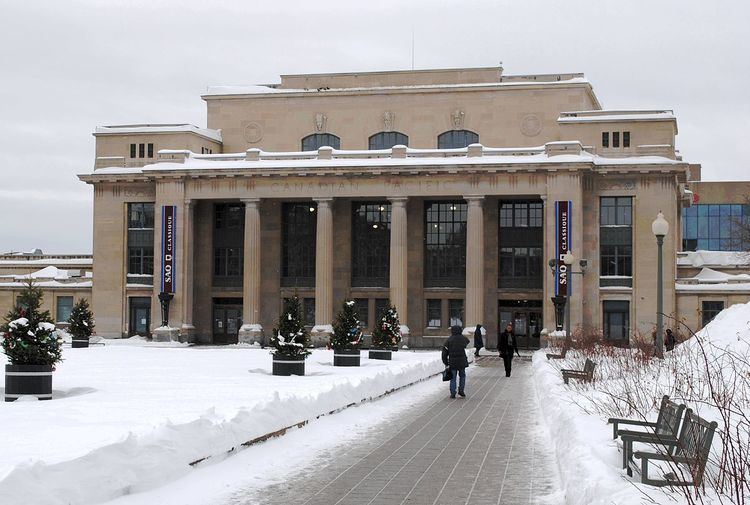
Attractions in the area include the old Park Avenue train station (now containing Parc Metro station and near the Parc commuter train station), Jarry Park, and TOHU, La Cité des arts du cirque (including the Cirque du Soleil and the École nationale du cirque). The former Miron and Francon quarries are also located here.
The former studios of CTV Montreal, TQS, CFCF radio & CFQR-FM (now CKBE-FM) were located in the Parc Extension section of the borough. Today, the borough hall is at the former studios of those stations on 405 Ogilvy Ave.
Education
The Commission scolaire de Montréal (CSDM) operates French-language public schools.
The English Montreal School Board (EMSB) operates English-language schools.
The Montreal Public Libraries Network operates the Le Prévost, Parc-Extension, and Saint-Michel libraries.