
Barangays ZIP code 2811 Local time Monday 11:07 PM | Time zone PST (UTC+8) Area 102.9 km² Mayor Marjorie L. Lagen | |
 | ||
Weather 24°C, Wind E at 8 km/h, 62% Humidity | ||
Villaviciosa, officially the Municipality of Villaviciosa (Ilocano: Ili ti Villaviciosa, Filipino: Bayan ng Villaviciosa), is a municipality in the province of Abra in the Cordillera Administrative Region (CAR) of the Philippines. The population was 5,392 at the 2015 census. In the 2016 electoral roll, it had 4,018 registered voters.
Contents
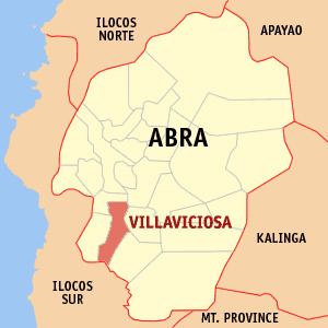
Map of Villaviciosa, Abra, Philippines
Geography
Villaviciosa is located at 17°26′N 120°38′E.
According to the Philippine Statistics Authority, the municipality has a land area of 102.93 square kilometres (39.74 sq mi) constituting 2.47% of the 4,165.25-square-kilometre- (1,608.21 sq mi) total area of Abra.
The municipality is geographically situated at the southern portion of Abra, bounded in the north-west by San Isidro, north by Bucay, east by Manabo and Luba, south by San Emilio, and west by Pilar.
Villaviciosa is accessible from Benguet by land transportation through the Abra-Ilocos Sur Road, the more frequently used route. From the nearby Province of Ilocos Sur, it is also accessible through the Candon via San Emilio to Luba‑Tamac, Villaviciosa Road and the Santa Maria‑Burgos via Pilar‑Villaviciosa Road.
Barangays
Villaviciosa is politically subdivided into 8 barangays.
Demographics
In the 2015 census, Villaviciosa had a population of 5,392. The population density was 52 inhabitants per square kilometre (130/sq mi).
In the 2016 electoral roll, it had 4,018 registered voters.