
 | ||
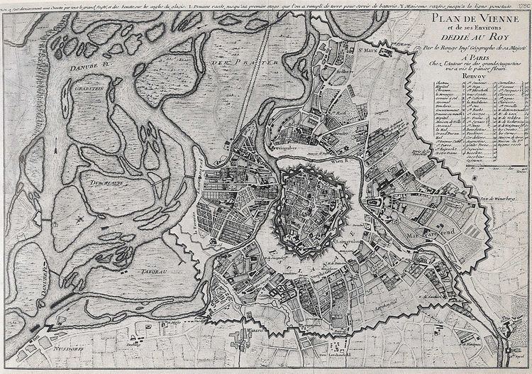
The Vienna Danube regulation (German: Wiener Donauregulierung) refers to extensive flood-control engineering along the Danube river in Vienna, Austria during the last 150 years. The first major dams or levees were built during 1870-75. Another major project was constructed during 1972-88, which created the New Danube and Danube Island (Donauinsel). Prior to regulation, the Danube in Vienna had been an 8-kilometre (5 mi) wide wetlands, as a patchwork of numerous streams meandering through the area (see maps).
Contents
History
In Vienna, the Danube river up until 1870, was almost totally unregulated. The river flowed through the wetlands on the left (east) bank of today's Danube course. Villages (like Jedlesee, Floridsdorf and Stadlau) were near the former main branch of the Danube and were particularly at risk of being inundated by the floods of the river.
After repeated severe flood damage, by 1810, Hofbau-Direktor Josef von Schemerl had already proposed regulation in the form of a new river bed, but his plans were not realized. Only during the years 1870 to 1875, was the Danube regulated for the first time. On the left bank, a 450-metre (1,480 ft) wide flood-prone area (Inundationsgebiet) was created with the dam Hubertusallee, covering today's municipal districts of Floridsdorf and Donaustadt. The new main branch, including shipping, was 280 metres (920 ft) wide, leaving the old river bed as the Old Danube.
Major high water in the years 1897, 1899 and 1954, led to more floods, especially concerning the right bank of the Danube at Handelskai ("Trade pier"). This proved that the regulation of the Danube was still insufficient.
After many years of studies, in 1972, a new flood-control project was started. Working up to 1988, within the inundation area, a new, 210-metre (690 ft) wide channel (Entlastungsgerinne) was created. The material excavated from the channel was placed between the Danube and the channel, creating the Danube Island. The channel, or New Danube, is protected by fortifications and is only used to divert flood waters. It is designed for a flow of 5 thousand cubic metres per second (180×10^3 cu ft/s). Overall, the Danube regulation is designed for a capacity of up to 14 thousand cubic metres per second (490×10^3 cu ft/s), which is the estimated maximum flow of a flooding which took place in 1501. The Danube Island (also called "Copa Kagrana" after the Brazilian "Copacabana" and the adjoining Kagran, a suburb of Vienna) and the New Danube now serves as a popular recreation area.
Flood years and levels
Major floods in Vienna were: