
Topo map USGS Silverton Prominence 480 m | Elevation 1,896 m First ascender Louis C. Fletcher | |
 | ||
First ascent Before 1918, possibly by Louis C. Fletcher et al. (surveyors) Easiest route East Ridge: moderate scramble, (class 2) Similar Big Four Mountain, Sloan Peak, Mount Pugh, Del Campo Peak, Three Fingers | ||
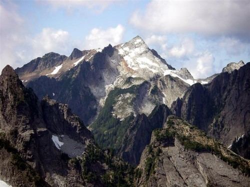
Vesper Peak is a peak along the Mountain Loop Highway region of the North Cascades of Washington state. It is about 18 miles (29 km) south of Darrington and 21 miles (34 km) east of Granite Falls, in the Mount Baker-Snoqualmie National Forest. Its gentle south and east slopes contrast with a sheer north face which offers "excellent technical routes".
Contents
Map of Vesper Peak, Washington 98252, USA
GeologyEdit
The peak is primarily composed of intrusive quartz diorite, but the south and southwest slopes are metavolcanic rock. Grossular garnet occurs in skarn zones on the peak, which have been mined for this mineral.
Climbing and recreationEdit
The peak was ascended in 1918 during a Mountaineers outing, but "they were likely preceded by prospectors and a geological survey party led by Louis C. Fletcher". The steep north face was first climbed in 1968 by Bruce Garrett and Jim Langdon; several routes exist on the face, with difficulties in the 5.6 to 5.8 range.
The summit can be reached from the Sunrise Mine Road (No. 4065), off the Mountain Loop Highway. The hike is a 10-mile (16 km) round trip with an elevation gain of 4,114 feet (1,254 m). The summit affords views of Glacier Peak, Sloan Peak, Mount Dickerman, Mount Pugh, Mount Rainier, Mount Stuart and a bit of the top of Mount Adams.