
Postal index 67100—67154 Founded 1962 Region Odessa Oblast | Established 1945 Time zone EET (UTC+2) Area 1,436 km² Population 31,083 (2015) Area code 4859 | |
 | ||
Subdivisions List 0 — city councils 2 — settlement councils22 — rural councilsNumber of localities: 0 — cities 2 — urban-type settlements79 — villages 1 — rural settlements | ||
Velyka Mykhailivka Raion (Ukrainian: Великомихайлівський район) is a raion (district) in Odessa Oblast of Ukraine. Its administrative center is the urban-type settlement of Velyka Mykhailivka. Population: 31,083 (2015 est.)
Contents
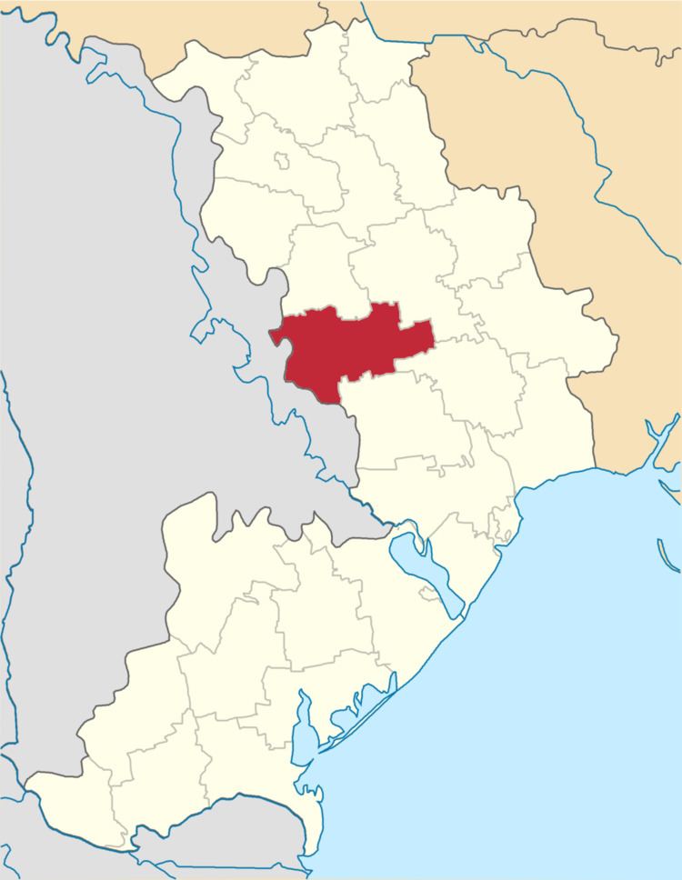
Map of Velykomykhailivs'kyi district, Odessa Oblast, Ukraine
History
The area was settled after 1792, when the lands between the Southern Bug and the Dniester were transferred to Russia according to the Iasi Peace Treaty. In particular, the settlement of Hrosulove was founded in 1793. The area was included in Tiraspol Uyezd, which belonged to Yekaterinoslav Viceroyalty until 1795, Voznesensk Viceroyalty until 1796, Novorossiya Governorate until 1803, and Kherson Governorate until 1920.
On 16 April 1920, Odessa Governorate split off, and Odessky Uyezd was moved to Odessa Governorate. In 1923, uyezds in Ukrainian Soviet Socialist Republic were abolished, and the governorates were divided into okruhas. Hrosulove was included into Odessa Okruha. On 7 March 1923 Hrosulove Raion with the administrative center in Hrosulove was established. In 1930, okruhas were abolished, and on 27 February 1932, Odessa Oblast was established, and Hrosulove Raion was included into Odessa Oblast. In 1946, Hrosulove was renamed Velyka Mykhailivka, and Hrosulove Raion was renamed Velyka Mykhailivka Raion.
On 7 March 1923 Tsebrykove Raion with the administrative center in Tsebrykove was established as well. On 30 December 1962 Tsebrykove Raion was abolished and merged into Velyka Mykhailivka Raion.