
 | ||
Similar Thusharagiri Falls, Chembra Peak, Anginda peak, Soochipara Falls, Banasura Hill | ||
Vellarimala (Malayalam: വെളളാരിമല)is a mountain range in Kerala, India, spread across Thiruvambady Panchayat in Kozhikode district and Meppadi Panchayat in Wayanad district.
Contents
Map of Vellarimala, Kerala 673603
Description
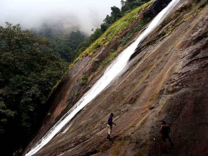
Vellarimala forms a part of a high hill range of what is otherwise known as Camel's Hump Mountains, a part of the Western Ghats. Most of the hill range falls in the Meppadi Forest Range of South Wayanad Division, with some parts falling in the Thamarassery Range of Kozhikode Division. They are semi-contiguous with Nilgiris or Nilgiri Hills in Tamil Nadu, separated by the Chaliyar Valley. The plateau of Wayanad lies on the eastern slopes of these hills and merges gradually with the Mysore plateau. The hill ranges are accessible by foot from Muthappanpuzha, near Anakkampoyil, a small town about 50 km from Kozhikode. About 6 km by foot from Muthappanpuzha on the way to Vellarimala hills is the waterfall called Olichuchattam. It is situated 15 km from Thiruvambady. KSRTC Bus Services are available from Thiruvambady to Anakkampoyil and Muthappanpuzha. Swargam Kunnu is also situated here. Vellarimala - Swargam Kunnu - Masthakappara - Olichuchattam - Marippuzha - Muthappanpuzha Trekking is available with forest permission. Now road is available from Thiruvambady to Marippuzha.
This block of compact high mountains is floristically and faunistically similar to the Nilgiri Hills.
The tallest peak in this range is called Vavul Mala. At an altitude of 2339m, it is the tallest of the Western Ghats to the north of Nilgiri Hills.