
Country India Time zone IST (UTC+5:30) Website www.wayanad.nic.in Population 816,558 (2011) ISO 3166 code ISO 3166-2:IN | State Kerala Vehicle registration KL-12, KL-72, KL-73 Area 2,131 km² Headquarters Kalpetta | |
 | ||
Colleges and Universities Kerala Veterinary and Animal Sciences University, Pazhassi Raja College Points of interest Chembra Peak, Edakkal Caves, Kuruvadweep, Thirunelli Temple, Ambukuthi mala Destinations Bandipur National Park, Kalpetta, Nagarhole National Park, Mudumalai National Park, Vythiri | ||
Wayanad District is a district in the north-east of Kerala state, India with headquarters at the town of Kalpetta. The district was formed on 1 November 1980 as the 12th district in Kerala by carving out areas from Kozhikode and Kannur districts. The district is 3.79% urbanised, with three municipal towns Kalpetta, Mananthavady and Sulthan Bathery.
Contents
- Map of Wayanad Kerala
- Location
- Etymology
- History
- Cities and towns
- Tourist attractions
- Geography
- Economy
- Demographics
- Administration
- Access
- References
Map of Wayanad, Kerala
Wayanad has seen a recent tourism boom and is now one of the most popular tourist destinations of Kerala. It is the only district in Kerala that shares its borders with both Karnataka and Tamil Nadu states. For this reason, it is often visited by tourists from these states. The only Earth Dam in India is Banasura Sagar Dam and the only pine forest of Kerala is Chandanathode. Pulpally in Wayanad boasts of the only Luv Kush Temple in Kerala and Vythiri has the only mirror temple in Kerala which is a Jain temple. The edicts and caves of Ambukuthimala and other evidences state that the place is as old as the beginning of the New Age Civilisation. . The district also houses the Wayanad Wildlife Sanctuary with four ranges namely Sulthan Bathery, Muthanga, Kurichiat and Tholpetty. Wayanad is also surrounded by the legendary wildlife sanctuaries of Bandipur , Muthanga and Nagarhole. Wayanad also has the largest population of Asian elephants in the world.
Location
Wayanad district is in the southern tip of the Deccan Plateau. Part of the Western Ghats is in the district. In the centre of the district hills are lower in height while the northern area has high hills. The eastern area is flat and open.
Etymology
The region was known as Mayakshetra (Maya's land) in the earliest records. Mayakshetra evolved into Mayanad and finally to Wayanad. The Folk etymology of the word says it is a combination of Vayal (paddy field) and Naad (land), making it 'The Land of Paddy Fields'. There are many indigenous tribals in this area. It is set high on the Western Ghats with altitudes ranging from 700 to 2100 m.
History
According to archaeological evidence, the Wayanad forests have been inhabited for more than 3,000 years. Historians are of the view that human settlement existed in these parts for at least ten centuries before Christ. Much evidence of New Stone Age civilisation can be seen in the hills throughout the present day Wayanad district. The Edakkal Caves have 6000 year old rock engravings from the Neolithic age. Recorded history of this district is available from the 18th century. In ancient times, this land was ruled by the Rajas of the Veda tribe.
The Kutumbiyas:
The two caves of Ampukuthimala (Edakal Caves) in Sulthan Bathery, with pictures on their walls and pictorial writings, speak volumes of a bygone civilisation. At the foot of the Edakal Male (hill) caves, Kannada inscriptions belonging to Kutumbiya clan of Mysore dating to c. 500 CE were discovered which read - 'Palapulitaanamtakaari', 'Sri Vishnu Varma Kutumbiya Kulavardhanasya li..it..a..'. As per Hultzch, an epigraphist from the department of epigraphy, Madras, it speaks of the glorious descendant of Kutumbiya clan, Kannada chieftain, Vishnu Varma, as one who killed many tigers.
The Gangas:
The recorded history of this district exists only from the 10th century onward. In 930 AD, emperor Ereyappa of Ganga Dynasty led his troops to the south west of Mysore - an invasion to the prosperous kingdom he had heard of from traders and Jain monks. Mission accomplished and he called the conquered kingdom ‘Bayalnad’ meaning the land of swamps. After Ereyappa, his sons Rachamalla and Battunga (or Butuga) fought each other for the new kingdom of their father’s legacy. Rachamalla was killed and Battunga became the undisputed ruler of Bayalnad.
The Kadmabas:
In the 11th century AD, Gangas were dethroned from Bayalnad by Kadamba dynasty of North Canara. Wayanad was at that time divided into two portions - Bira Bayalnad and Chagi Bayalnad. One of the Mysore inscriptions (alluding perhaps to the treacherous beauty of the country, which attracted the stranger and then laid him low with malaria) says 'an adulteress with black waving curls, as adulteress with full-moon face, an adulteress with endless side-glances, an adulteress with adorned slim figure was this storeyed mansion, the double Bayalnad'. Kadamba Bayalnad emerged as a rule in the 11th century under their chief Raviyammarasa with Kirttipura in Punnad their capital. Kanthirava (1090 CE) was described as ruling Chagi-Bayalnad. Iravi-Challamma (1108 CE) was the ruler of Bira-Bayalnad.
The Hoysalas:
In 1104 AD Vishnuvardhana of Hoysala invaded Bayalnad followed by Vijayanagara dynasty in the 14th century. A Kadamba king, Mukkanna-Kadamba ruled Bayal-nad in and around 1138 CE.
The Vijayanagara empire:
A feudatory chieftain of Sangama dynasty of Vijaynagar, Immadi Kadamba Raya Vodeyayya of Bayalnad Kadambas, is said to have ruled Bayalnad.
The Mysore Wodeyars and the Sultans:
In 1610 AD Udaiyar Raja Wadiyar of Mysore drove out Vijayanagara General and became the ruler of Bayalnad and the Nilgiris. Bayalnad is the present Wayanad. When Wayanad was under Hyder Ali’s rule, the ghat road from Vythiri to Thamarassery invented. Then the British rulers developed this route to Carter road. When Wayanad was under Tipu Sultan's rule British invasion started. Tussle and turbulent times followed. The British claimed Wayanad under the 1792 treaty of Srirangapatna citing it was part of Malabar. Tipu Sultan went in appeal before the Governor General. Considering his arguments, relying on the successive Karnataka rule for centuries in Wayanad and its geographical detachment from Malabar, in 1798, Governor General Lord Mornington declared by proclamation that Wayanad had not been ceded to the East India Company by the treaty of 1792. Consequently, the British troops withdrew from Wayanad conceding to Tipu’s rule. In 1799, after the fall of Sultan, the British handed over Wayanad by the treaty of 1799 to the Raja of Mysore. But by a supplementary treaty dated 29 December 1803 the East India Company repossessed Wayanad and thereafter administrated by Col. Arthur Wellesley from Srirangapatna and North Wayanad came under the rule of the Pazhassi Raja dynasty of ancient Kottayam.
Pazhashi Raja:
In later days, Wayanad came under the rule of the Pazhassi Rajahs of Kottayam royal dynasty. When Hyder Ali became the ruler of Mysore, he invaded Wayanad and brought it under his sway. In the days of Tipu, Wayanad was restored to the Kottayam royal dynasty. But Tipu handed over the entire Malabar region to the British, after the Srirangapattana truce, he made with them. This was followed by fierce and internecine encounters between the British and Kerala Varma Pazhassi Rajah of Kottayam. When the Rajah was driven to the wilderness of Wayanad, he organised the war-like Kurichiya tribals into a sort of people's militia and engaged the British in several guerrilla type encounters.
British Rule:
In the end, the British could get only the dead body of the Rajah, who killed himself somewhere in the interior of the forest. Thus, Wayanad fell into the hands of the British and with it came a new turn in the home of this area. The British authorities opened up the plateau to the cultivation of tea and other cash crops by constructing roads across the dangerous slopes of Wayanad, to Kozhikode and Thalassery. Later, they extended these new roads to the cities of Mysore and Ooty through Gudalur. Settlers emigrated from all parts of Kerala and the fecund lands proved a veritable goldmine with incredible yields of cash crops. Agriculture Cultivation started broadly after 1900 A.D onwards. Wayanad eventually became part of Kerala despite its geographical delimitations and political descent in 1956 on State’s reorganisation. Even now there is a considerable Kannada speaking population and the reminiscence of centuries old Karnataka rule is omnipresent in Wayanad. When the State of Kerala came into being in November 1956, Wayanad was part of Kannur district. Later, south Wayanad was added to Kozhikode district. To fulfil the aspirations of the people of Wayanad for development, North Wayanad and South Wayanad were carved out and joined together to form the present district of Wayanad. This district came into being on 1 November 1980 as one the twelve districts of Kerala, consisting of three taluks; Vythiri, Mananthavady, and Sulthan Bathery.
Cities and towns
Tourist attractions
Geography
Wayanad district stands on the southern tip of the Deccan plateau and includes part of the Western Ghats. Quite a large area of the district is covered by forest but the continued and indiscriminate exploitation of the natural resources point towards an imminent environmental crisis. It has a large amount of dry and moist deciduous forest. Wayanad is home to endangered species.
The Kabini River, one of the three east flowing rivers of Kerala, is an important tributary of the Kaveri River. Almost the entire Wayanad district is drained by Kabini and its three tributaries, the Panamaram, Mananthavady, and Kalindy rivers. The Banasura Sagar Dam is built on one of the tributaries of the Kabini River.
Economy
In 2006, the Ministry of Panchayati Raj named Wayanad one of the country's 250 most backward districts (out of a total of 640). It is one of the two districts in Kerala currently receiving funds from the Backward Regions Grant Fund Programme (BRGF).
Demographics
It is the least populous district in Kerala. Unlike all other 13 districts of Kerala, in Wayanad district, there is no town or village named same as the district (i.e., there is no "Wayanad town").
According to the 2011 census Wayanad district had a population of 816,558, roughly equal to the nation of Comoros. This gives it a ranking of 482nd in India (out of a total of 640). The district has a population density of 383 inhabitants per square kilometre (990/sq mi). Its population growth rate over the decade 2001–2011 was 4.6%. Wayanad has a sex ratio of 1035 females for every 1000 males, and a literacy rate of 89.32%, the lowest in the state. Paniyas, Uraali Kurumas, and Kurichiyans comprise the tribes in Wayanad. Badagas are present in 21 hamlets spread across Wayanad. The entire Wayanad region fell under the Kannada speaking area as per the linguistic survey and history of Colonel Wilks.
Administration
Access
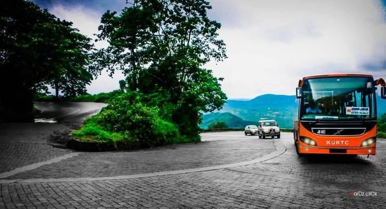
The Kozhikode–Mysore National Highway 212 (NH 212) passes through Wayanad district. En route to Mysore on NH 212, past Wayanad district boundary, which is also the Kerala state boundary, NH 212 passes through Bandipur National Park. There is a night traffic ban imposed on this stretch since 2009. The alternate road to take is, leave NH 212 at Kalpetta and proceed to Mysore through Mananthavady, Kutta, Gonikoppal, and Hunsur. The nearest railway stations are Calicut and Thalassery. Kozhikode International Airport at Karipur is the nearest airport, 95 km from Kalpetta. Kannur International Airport, under construction at Mattannur is at a distance of 70 km from Mananthavady.