
Time zone CET (UTC+1) Area 27.92 km² Population 610 (1999) | INSEE/Postal code 18272 /18300 Local time Saturday 8:37 PM | |
 | ||
Weather 12°C, Wind SW at 6 km/h, 70% Humidity | ||
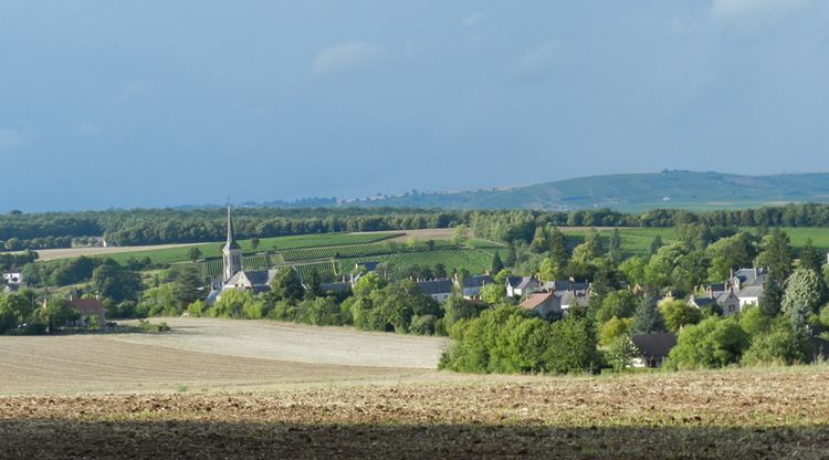
Veaugues is a commune in the Cher department in the Centre region of France.
Contents
Map of 18300 Veaugues, France
Geography
An area of winegrowing, forestry and farming comprising the village and a couple of hamlets situated on the banks of the small Planche-Goddard river, about 24 miles (39 km) northeast of Bourges at the junction of the D86 with the D49, D59 and D955 roads. The commune is one of 14 that grow grapes for the production of Sancerre AOC wine.
Sights
References
Veaugues Wikipedia(Text) CC BY-SA