
Length 11 km (6.8 mi) Population 665 (2011) | Width 3 km (1.9 mi) Area 25.7 km² | |
 | ||
Similar Skellig Islands, Ring of Kerry, Skellig Michael, Dingle Peninsula, Geokaun | ||
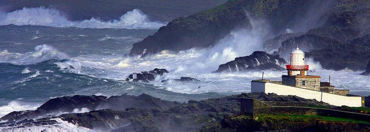
Valentia Island (Irish: Dairbhre, meaning "The Oak Wood") is one of Ireland's most westerly points. It lies off the Iveragh Peninsula in the southwest of County Kerry. It is linked to the mainland by the Maurice O'Neill Memorial Bridge at Portmagee. A car ferry also departs from Reenard Point to Knightstown, the island's main settlement, from April to October. A second, smaller village named Chapeltown is located at roughly the midpoint of the island, 3 kilometres (1.9 miles) from the bridge. The permanent population of the island is 665 (as of the 2011 CSO Census). It's approximately 11 kilometres (7 miles) long by almost 3 kilometres (2 miles) wide.
Contents
- Map of Valentia Island Co Kerry Ireland
- Name
- History
- Places of interest
- Weather station location and Climate
- Sport
- Notable people
- References
Map of Valentia Island, Co. Kerry, Ireland
Name
The English name Valentia Island (also spelled Valencia Island) doesn't come exactly from the Spanish city of Valencia, but from a settlement on the island called An Bhaile Inse or Beal Inse ("mouth of the island" or "island in the mouth of the sound"), which in turn could have been reinterpreted as similar to the Spanish town by Englishmen and Spaniards sailors and settlers alike (there is a grave marker to Spanish sailors lost at sea in the Catholic cemetery at Kylemore).
History
Valentia was the eastern terminus of the first commercially viable transatlantic telegraph cable. The first attempt in 1857 to land a cable from Ballycarbery Strand on the mainland just east of Valentia Island ended in disappointment. After subsequent failures of cables landed at Knightstown in 1858 and Foilhommerum Bay in 1865, the vast endeavor finally resulted in commercially viable transatlantic telegraph communications from Foilhommerum Bay to Heart's Content, Newfoundland in 1866. Transatlantic telegraph cables operated from Valentia Island for one hundred years, ending with Western Union International terminating its cable operations in 1966.
Prior to the transatlantic telegraph, American longitude measurements had a 2,800-foot (850 m) uncertainty with respect to European longitudes. Because of the importance of accurate longitudes to safe navigation, the U.S. Coast Survey mounted a longitude expedition in 1866 to link longitudes in the United States accurately to the Royal Observatory in Greenwich. Benjamin Gould and his partner A. T. Mosman reached Valentia on 2 October 1866. They built a temporary longitude observatory beside the Foilhommerum Cable Station to support synchronized longitude observations with Heart's Content, Newfoundland. After many rainy and cloudy days, the first transatlantic longitude signals were exchanged between Foilhommerum and Heart's Content on October 24, 1866.
In 1993, an undergraduate geology student discovered fossilised tetrapod trackways (51°55′51″N 10°20′38″W), footprints in mud preserved in Devonian rocks on the north coast of the island. About 385 million years ago, a primitive vertebrate passed along a muddy shoreline in the equatorial swampland that is now southwestern Ireland and left prints as if in wet concrete. The prints were preserved by silt overlying them, and were converted to rock over the ages. The Valentia Island trackways are among the oldest signs of vertebrate life on land.
Places of interest
The combined features and history of the island make it an attractive tourist destination, easily accessible from the popular Ring of Kerry route.
Weather station location and Climate
The Valentia Island Weather Station is located 51° 56' 23"N, 10° 14'40"W and is 25 metres (82 feet) above mean sea level. It is one of the 22 coastal weather stations whose reports are broadcast as part of the BBC Shipping Forecast. Valentia Observatory is part of Met Éireann, the Irish Meteorological Service. The observatory was set up in August 1868. Valentia island is, on average, the wettest weather station in Ireland. The monthly averages for Sunshine and Rainfall are based on 2010 statistics which are around average apart from July, which received only 40% of its normal sunshine hours and 219% of its normal rainfall. Valentia island also has a station for Navtex transmissions. Valentia Island sits on the eastern edge of the Atlantic Ocean. Despite it being on the same latitude as St Anthony in Newfoundland on the opposite side of the Atlantic Ocean, it enjoys much milder winters thanks to the moderating effect of prevailing west or south west winds, and the effects of the warming Gulf Stream current. Snow and frost are rare, and because of this the island can support many sub-tropical varieties of plants.
Sport
Valentia Young Islanders GAA is the local Gaelic Athletic Association club.
Valentia is a popular fishing location, and Valentia waters hold the Irish records for conger eel, red sea bream, Ray's bream and lesser spotted dogfish.
Notable people
Valentia was considered home to Mug Ruith, a powerful blind druid in Irish mythology.
The O'Sullivans, headed by the O'Sullivan Beare, owned much of Valentia until the 17th century.
The noted naturalist Maude Jane Delap lived and worked in Knightstown, carrying out important research into the marine life surrounding Valentia and identifying many new species.
Valentia is the home of former Gaelic footballer, Mick O'Connell and the birthplace of John J "Scéilig" O'Kelly, leader of Sinn Féin from 1926.
Gaelic footballer Ger O'Driscoll was born on Valentia Island.
The American solo rock climber Michael Reardon died on 13 July 2007 at the Fogher Cliffs of Valentia Island when he was swept out to sea following a successful climb.
Gerald Spring Rice, 6th Baron Monteagle of Brandon was brought up on the island, as were many other members of the Spring Rice family.