
OSI/OSNI grid V386770 Prominence 266 m Listing Marilyn | Elevation 266 m | |
 | ||
Similar Mullaghanattin, Knocknadobar, Fauscoum, Baurtregaum, Mullaghanish | ||
Geokaun Mountain (Irish: an Geocán) is the highest mountain on Valentia Island, County Kerry.
Contents
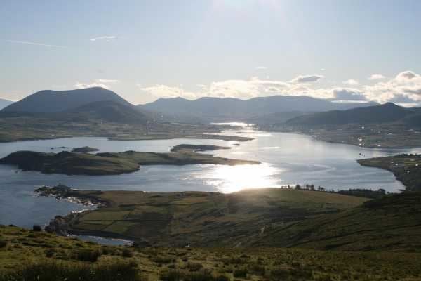
Map of Geokaun, Feaghmaan West, Co. Kerry, Ireland
Geography
On Geokaun's northern face the 180-metre (600 ft) Fogher Cliffs (Irish: an Fhoithir) meet the sea.
From the summit there are views of the Skellig Islands, Dingle Peninsula, the Blasket Islands, Beginish Island, Cahersiveen, Portmagee and Macgillycuddy's Reeks, including three of Ireland's six highest mountains: Carrauntoohil, Beenkeragh and Caher.
Access
The summit of Geokaun Mountain is privately owned, and a fee is required to access the mountain via the main track to the summit.
Situated along the main path up the mountain are 4 viewing areas with 36 information plaques on topics of social, environmental and historical interest in the area. These plaques include information on subjects such as: