
Existed: 1965 – present Length 144.5 km | East end: SR-95 near Hanksville Constructed 1965 | |
 | ||
West end: SR-95 at Trachyte Junction | ||
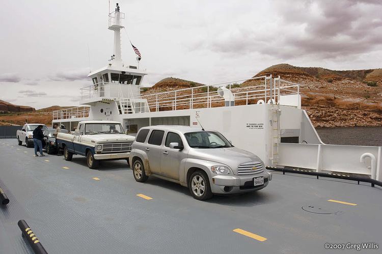
State Route 276 is a state highway located in southwest-central San Juan, eastern Garfield, and a tiny portion of northeastern Kane counties, in the southeast of the U.S. state of Utah. The northern section was created in 1965 as an access road to Bullfrog Basin, while the southern section was added in 1969, but was designated SR-263 until 1985. The two are connected by the Charles Hall Ferry across Lake Powell. The ferry is the only auto ferry in a landlocked western state.
Contents
Map of UT-276, Lake Powell, UT 84533, USA
Route description
Separated by the Colorado River, Lake Powell, and Glen Canyon, SR-276 is in two sections. The two sections are connected via the John Atlantic Burr Toll Ferry. The first section runs 43 miles (69 km) south-southwest, from the junction of SR-95 northeast of Mount Hillers to the Colorado River and Bullfrog (also called Bullfrog Basin). The second section runs east-northeast for 49 miles (79 km), from the marina and ferry at Halls Crossing, to rejoin State Route 95 near Natural Bridges National Monument. The northern section of SR-276 passes through the tiny community of Ticaboo along the way. The state of Utah's administrative portion of the highway ends at the boundary of the Glen Canyon National Recreation Area (northern portion 35 miles (56 km), southern portion 36 miles). The U.S. Department of the Interior maintains the road surface within the Glen Canyon National Recreation Area.
History
The State Road Commission designated SR-276 in 1965, linking SR-95 with the Bullfrog Basin portion of the new Glen Canyon National Recreation Area. The original planned alignment followed an existing unpaved county road, beginning at the former alignment of SR-95 at Trachyte Junction (roughly 38°02′17″N 110°37′23″W) and heading generally south to the junction of Shitamaring Creek and Lost Spring Wash. The proposed road continued down Shitamaring Creek and Hansen Creek to the recreation boundary. However, when built in the late 1960s, the final route was east of the existing county road, only joining the initial proposal along Hansen Creek south of Ticaboo.
State Route 263 was created by the state legislature in 1969, connecting the recreation area near Halls Crossing with SR-95 near Natural Bridges National Monument. This was an existing county road, only requiring minor realignments west of Red House Spring. Ferry service between Bullfrog Basin and Halls Crossing began in 1985, and that year SR-276 was extended to absorb SR-263 for continuity.