
Elevation 1,190 m (3,900 ft) Postal code 39016 | Area 208 km² Local time Friday 2:05 AM Dialling code 0473 | |
 | ||
Region Trentino-Alto Adige/Südtirol Frazioni St. Gertraud (San Gertrude), St. Nikolaus (San Nicolò), St. Walburg (Santa Valburga) Demonym(s) German: UltnerItalian: della val d'Ultimo Weather -5°C, Wind NW at 6 km/h, 57% Humidity Points of interest Comprensorio Sciistico Schwemmalm | ||
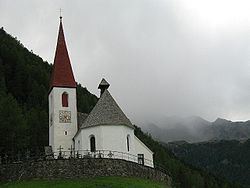
Ulten ( [ˈʊltn̩]; Italian: Ultimo [ˈultimo]) is a comune (municipality) in South Tyrol in northern Italy, located about 35 kilometres (22 mi) west of Bolzano.
Contents
- Map of Ulten Province of Bolzano South Tyrol Italy
- Coat of arms
- Linguistic distribution
- Demographic evolution
- References
Map of Ulten, Province of Bolzano - South Tyrol, Italy
Coat-of-arms
The shield is party per pale of argent; the first part shows half Tyrolean eagle; the second part is tierced per fess of sable and argent. It is the arms of the Counts of Eschenlch and the Tyrolean eagle represents the membership to the Tirol. The emblem was granted in 1967.
Linguistic distribution
According to the 2011 census, 99.40% of the population speak German, 0.53% Italian and 0.07% Ladin as first language.
Demographic evolution
References
Ulten Wikipedia(Text) CC BY-SA