
Area 181.8 km² | Region Kantō Phone number 0274-59-2111 Population 1,265 (Feb 2015) Local time Friday 1:12 AM | |
 | ||
Address 11 Ōaza Kawawa, Ueno-mura, Tano-gun, Gunma-ken 370–1614 Weather -1°C, Wind W at 6 km/h, 76% Humidity Points of interest Kawawa Natural Park, Chushoji, Mount Osutaka, Mount Takamagahara, Nokurizawa Onsen | ||
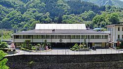
Ueno (上野村, Ueno-mura) is a village located in Tano District of southwestern Gunma Prefecture in the northern Kantō region of Japan. As of February 2015, the village had an estimated population of 1,265 and a population density of 6.96 persons per km². Its total area was 181.85 km². The village has the lowest population density of any municipality in Japan.
Contents
- Map of Ueno Tano District Gunma Prefecture Japan
- Geography
- Surrounding municipalities
- History
- Economy
- Education
- Transportation
- Highway
- International relations
- Local attractions
- References
Map of Ueno, Tano District, Gunma Prefecture, Japan
Geography
Ueno is located in the extreme southwestern portion of Gunma Prefecture, bordered by Saitama Prefecture to the south and Nagano Prefecture to the west.
Surrounding municipalities
History
During the Edo period, the area of present-day Ueno was part of the tenryō territory administered directly by the Tokugawa shogunate in Kōzuke Province.
Ueno village was established within Minamikanra District, Gunma Prefecture on April 1, 1889 with the creation of the municipalities system after the Meiji Restoration. In 1896, Minamikanra District was united with Midono and Tago Districts to create Tano District. On August 12, 1985, Japan Airlines Flight 123, heading from Haneda Airport to Itami Airport, crashed into an area within the Ueno Village limits, killing 520 people in the world's deadliest single-aircraft aviation accident.
Economy
The economy of Ueno is heavily dependent on agriculture and forestry.
Education
Ueno has one elementary school and one middle school.
Transportation
Ueno is not served by any railway stations.