
Country State | Language spoken District Tirupur district | |
Map of Udumalaipettai
Udumalai, also known as Udumalaipettai, is a town in Tirupur district in the Indian state of Tamil Nadu. It is the headquarters of Udumalaipettai taluk and as of 2011, the town had a population of 61,133.
Contents
- Map of Udumalaipettai
- Udumalaipettai to munnar
- History
- Geography
- Demographics
- Education
- Economy
- Transport
- Tourism
- References
Udumalaipettai to munnar
History
The municipality was established in 1918 and upgraded to second grade municipality in 1970. It was declared as a first grade municipality in 1979 and further upgrades to selection grade municipality in 1984. The extent of the municipality is 7.41 km2 of which 6.582 km2 is urban and 0.828 km2 is rural. The city was part of Coimbatore district until 2008 when it became part of the newly formed Tiruppur district, a change which was opposed by the residents.
Geography
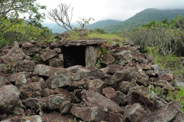
Udumalai is surrounded by Western Ghats on three sides. The average altitude of the town is 1208 feet above MSL. The topography is undulated and general slope is from west to North. Black clay soil is the predominant soil of the area. The town gets major rainfall during the south west monsoon period. The average annual rainfall is 501.40 mm. Black and red soil types are found in the town. The soil contains more of alumina and gypsum. While black soil area is utilized for agriculture, the areas with red soil has more urbanized usages.
Demographics
According to 2011 census, Udumalaipettai had a population of 61,133 with a sex-ratio of 1041 females for every 1000 males, much above the national average of 929. A total of 4,939 were under the age of six, constituting 2,489 males and 2,450 females. Scheduled Castes and Scheduled Tribes accounted for 8.67% and .07% of the population respectively. The average literacy of the town was 83.85%, compared to the national average of 72.99%. The town had a total of 17132 households. There were a total of 24,756 workers, comprising 226 cultivators, 289 main agricultural laborers, 450 in house hold industries, 21,403 other workers, 2,388 marginal workers, 51 marginal cultivators, 70 marginal agricultural laborers, 46 marginal workers in household industries and 2,221 other marginal workers. As per the religious census of 2011, Udumalaipettai had 81.83% Hindus, 14.49% Muslims, 3.19% Christians, 0.01% Sikhs, 0.01% Buddhists and 0.46% following other religions.
Education
There are about fifteen higher secondary schools and three colleges namely Vidyasagar college of Arts and Science, Government Arts and Science college] and GVG College for women.
Government is running Higher Secondary School for boys and girls separately along with one Co-educational school located in centre of the town.
Economy
The town, in the 1980s and 1990s, had a developed spinning industry but it has since declined due to labor shortages and other labor related issues. There are paper manufacturing plants located alongside the Amaravathi River. The surrounding areas has seen a surge in windmill installations because of the location of the town across the Palghat Gap.
Only 1.25% of land to the total area of the town is covered under agricultural usage. Mainly coconut trees and vegetables are grown in this area., where as, agricultural activities are developed mainly in the hinterlands of the town, wherever water facility is available, wet crops like paddy, sugarcane, etc., are grown in those areas. According to 1991 census, 33.82% of the total population of the town constitutes the working force. The Secondary and tertiary sectors were the major components of the working population accounting for 32.22% and 60.27% respectively. The primary sector accounted only for 7.81%. The predominant occupation of the town is trade and commerce activities. Trade and Commerce, Manufacturing industrial activities and other services accounts to 27.52%, 24.74% and 23.50% respectively of the total working force.
Transport
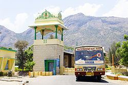
Udumalpet is connected with Coimbatore and Tiruppur by highways and Major District roads. The total length of roads, streets within corporate limits is about at 83.022 km. Consisting of 8.983 km of concrete road, 47,772 km. Of B.T roads and 26.627 km of other types of roads. The street pattern within the town is generally narrow about 83.022 km of roads are within the corporatation area and about 9.0 km belonging to the category of Major District Roads and National Highways. The town is located in the Pollachi-Palani section of the Indian railways.
Tourism
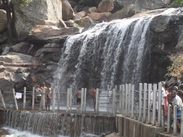
The town is surrounded by hills and has a good weather throughout the year. Waterfalls in Thirumoorthy hills draw tourists and tt takes half an hour to reach the falls by trekking from the Thirumoorthy Temple. A drive on the Udumalpet-Munnar road gives views of the Western Ghats. Chinnar is 25 km (16 mi) from Udumalpet and the reserve forests of Indira Gandhi Wildlife Sanctuary and National Park and Chinnar Wildlife Sanctuary are located nearby.