
Existed: 1927 – present Constructed 1927 | Length 131.1 km | |
 | ||
Counties | ||
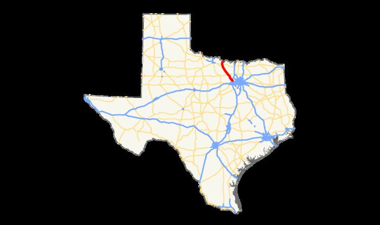
U.S. Route 81 (US 81) is a U.S. Highway that begins at an interchange with Interstate 35W/U.S. Route 287 in northern Fort Worth in Texas. US 81 leaves the state and crosses the Red River into Oklahoma between Ringgold and Terral.
Contents
Route description
US 81 begins at an interchange with Interstate 35W/U.S. Route 287 in northern Fort Worth. The two highways travel northwest as a freeway, passing by the Bureau of Engraving and Printing near Blue Mound Road (Farm to Market Road 156), through the city's northwest side. US 81/287 leave the city of Fort Worth and enter Wise County near Avondale. The two highways run through or near the towns of Rhome, New Fairview, Decatur, Alvord, and Sunset before separating in southern Bowie. US 81 runs through the town as Wise Street, running in a more east–west direction before turning in a more north–south direction at Farm to Market Road 174. The highway has a mostly rural route, running through western Montague County, before crossing the Red River into Oklahoma.
History
US 81 at its inception in 1926 followed the route of State Highway 2, which began in Laredo and passed through San Antonio, Austin, Waco, and Fort Worth before passing over the Red River into Oklahoma four miles (6 km) north of Ringgold. The 1936 Official Map of the Highway System of Texas clearly shows the route labeled both as US 81 and S.H. 2. It was cosigned with U.S. Route 83 for 18 miles (29 km) from Laredo to 2 miles (3.2 km) south of Webb, with U.S. Highway 79 for 18 miles (29 km) from Austin north to Round Rock, and with U.S. Route 77 for 33 miles (53 km) from Waco to Hillsboro. In 1940 U.S. Route 287 was extended south into Texas, and a 67-mile (108 km) stretch from Fort Worth northwest to Bowie was cosigned with US 81. The Summer 1941 Texas Highway Map shows this pairing, and the current southern terminus of US 81 is still cosigned with US 287.
The Spring and Summer 1949 Texas Highway Department Official Map designates the length of US 81 from Laredo to Fort Worth as part of the National System of Interstate Highways, but no numeric designation was given at the time.
It was not until 1959 that parts of US 81 in Texas appeared on the Texas Official Highway Travel Map cosigned with Interstate 35 shields. Succeeding maps reflect the slow completion of Interstate 35 and I-35W over the stretch of US 81 between Laredo and Fort Worth, with the 1978-79 Texas Official Highway Travel Map showing only a 14-mile (23 km) section from Encinal north to 3 miles (4.8 km) south of Artesia Wells as incomplete, and the 1980 Texas Official Highway Travel Map showing that section completed. In 1980, US 81 was cosigned with I-35 and I-35W except where the Interstate bypassed towns, with US 81 providing the main route through town and then reconnecting with I-35 on the other side. The longest section of US 81 in 1980 not cosigned with the Interstate ran from I-35 in Hillsboro 20 miles (32 km) north to I-35W, just north of Grandview. This section of US 81 became State Highway 81 in 1991 when most of US 81 in Texas was decommissioned.