
Existed: 1926 – present States: IowaMinnesota Constructed 1926 | Length 517.8 km | |
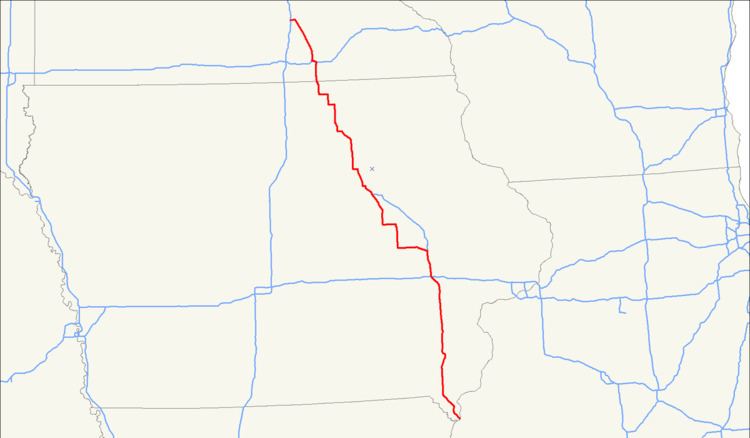 | ||
U.S. Highway 218 is an original United States Highway, created in 1926. Although technically a spur of U.S. Route 18, US 218 neither begins nor ends at US 18, but overlaps US 18 for 8 miles (13 km) near Charles City, Iowa. US 218 begins at U.S. Route 136 in downtown Keokuk and ends 319 miles (513 km) away at Interstate 35 and U.S. Route 14 at Owatonna, Minnesota. A large portion of US 218 in Iowa is part of the Avenue of the Saints, which connects St. Louis, Missouri, and Saint Paul, Minnesota.
Contents
- Map of US 218 United States
- Iowa
- Minnesota
- History
- Mount Pleasant business route
- Waverly business route
- Charles City business route
- References
Map of US-218, United States
Iowa
U.S. 218 is part of the Avenue of the Saints between Floyd and Cedar Falls, and again between Cedar Rapids and a point south of Donnellson. North of Mount Pleasant, the parts of US 218 that follow the Avenue have been completely upgraded to four lanes, with either at-grade intersections or controlled access. When 218 is part of the Avenue of the Saints, it is co-signed with Iowa Highway 27.
Minnesota
U.S. 218 enters the state at Lyle, in Mower County. It follows along the east side of the Iowa, Chicago, and Eastern Railroad line as it continues northward through farm fields. Southeast of Austin, U.S. 218 angles northeastward to bypass the city, its former route following County Road 45 into town.
U.S. 218 passes by the Austin Municipal Airport just before its interchange with Interstate 90. The highway runs concurrent with I-90 for nearly three miles through northern Austin. When U.S. 218 departs from the interstate and turns back north, it becomes a four-lane divided highway for a short distance. After its junction with State Highway 251, the highway angles north-northwestward again following the IC&E rail line, this time on the west side of the tracks.
The highway enters Dodge County for less than a mile, then reaches Steele County, Blooming Prairie, and an 8-block-long concurrency with State Highway 30. It continues north-northwest after leaving Blooming Prairie, traveling through predominantly agricultural scenery. It passes by Oak Glen Lake before going through the unincorporated community of Bixby.
After passing through the unincorporated community of Pratt, U.S. 218 meets U.S. 14 at a folded diamond interchange. 218 runs westward concurrent with 14, while its historic route through downtown Owatonna continues ahead as County Road 48. After an interchange with County Road 45 (former U.S. 65), 218 and 14 pass by Kaplan's Woods Park and reach Interstate 35, where U.S. 218 ends.
Legally, the Minnesota section of U.S. 218 is defined as Route 40 in Minnesota Statutes § 161.114(2).
History
In 1913, work on the road that is now U.S. 218 was begun. At this time it was called the Red Ball Route. It was called this because the original route was marked with poles which had red balls, six inches in diameter, mounted on each side. In 1920, the Minnesota portion of the route was designated as Constitutional Route 40, as part of the Babcock Amendment that established the Minnesota trunk highway system.
In Iowa, U.S. 218 was extended from its previous southern terminus, at its intersection with U.S. 30 in Benton County, in 1934 when U.S. Highway 161 was split and renamed. The former U.S. 161 had extended from Dubuque, through Cedar Rapids, to Keokuk. After the split, the section of former U.S. 161 from Dubuque to Cedar Rapids extended U.S. 151 south, and the section of U.S. 30 from the former terminus of U.S. 218 to its intersection with the former U.S. 161 in Cedar Rapids, along with the section of former U.S. 161 from Cedar Rapids to Keokuk, extended U.S. 218 south.
In 1965, U.S. 218 was rerouted along bypasses of Austin, Minnesota and Owatonna, Minnesota, the latter following a route that would later become the U.S. 14 bypass of that city as well.
Highway 218 was featured in the Bellamy Brothers 1976 song "Highway 2-18 (Hang On To Your Dreams)". It was track A5 on their first album, Bellamy Brothers – Featuring "Let Your Love Flow".
Mount Pleasant business route
U.S. Highway 218 Business (US 218 Business) was designated along a former routing of US 218 through Mount Pleasant, the northernmost 0.7 miles (1.1 km) are officially known as Iowa 438. The routing was created as a result of construction of the Avenue of the Saints corridor through Iowa. The new Avenue of the Saints corridor took US 218 / IA 27 and US 34 around the eastern and northern edges of Mount Pleasant. The Iowa 438 section of US 218 Business serves as a connector from southbound US 218 / Iowa 27 to westbound US 34.
Waverly business route
US 218 Business in Waverly was designated December 2, 1998, on the old segment of US 218 after it was routed around Waverly. The business route spans 6.6 miles (10.6 km). It intersects Iowa 3 in downtown Waverly and the two routes run concurrently for about 1 mile (1.6 km). South of Iowa 3, US 218 Business is officially known as Iowa Highway 116. US 218 Business begins at exit 198 of US 218 / IA 27 south of Waverly and ends at exit 205 of US 218 / IA 27.
Charles City business route
US 218 Business in Charles City was designated along the old alignment of US 218 in 2000 after the construction of the Avenue of the Saints corridor created a bypass around Charles City. Upon its designation, the route was officially known by two Iowa state highways – Iowa Highway 337 and Iowa Highway 162. Iowa 337 was turned over to local jurisdictions in 2001 and Iowa 162 was turned over in 2006 after US 18 was relocated through Charles City.