
Existed: 1926 – present Length 869 km | Constructed 1926 | |
 | ||
East end: | ||
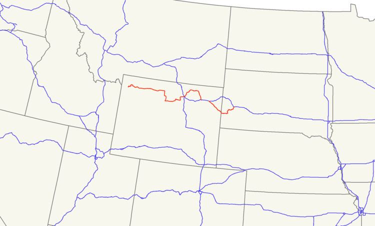
U.S. Route 16 (US 16) is an east–west United States Highway between Rapid City, South Dakota and Yellowstone National Park in Wyoming.
Contents
Map of US-16, United States
As of 2004, the highway's eastern terminus is at a junction with Interstate 90/U.S. Route 14 (I-90/US 14), concurrent with I-190, in Rapid City, South Dakota. The western terminus is the east entrance to Yellowstone National Park, concurrent with US 14 and US 20.
Wyoming
US 16 in Wyoming crosses through the towns of Newcastle and Upton before joining I-90 near Moorcraft. It runs concurrently with I-90 to Gillette, where it splits off north and then arcs back down to the town of Buffalo. From Buffalo it goes over the Powder River Pass on its way to Worland. In Worland, it turns north and overlaps US 20 through the towns of Basin and Greybull. In Greybull, the two routes combine with US 14 and go west to Cody and into Yellowstone National Park. For most of the way it is a two-lane road.
South Dakota
US 16 is also known as Mount Rushmore Road in western South Dakota. The highway enters South Dakota east of Newcastle, Wyoming. It travels near Jewel Cave, the second-longest cave in the world. The highway goes through the city of Custer and shares alignment with US 385. East of Hill City, US 16 splits off US 385. It then becomes a four-lane divided highway, with the two roadways separated by up to a half-mile (0.8 km) in some places, including the old gold-mining town of Rockerville, South Dakota, which is contained entirely between the two roadways. In Rapid City, a newly complete truck bypass runs along Catron Boulevard and Elk Vale Road up to Exit 61 on I-90.
The South Dakota section of US 16 is defined at South Dakota Codified Laws § 31-4-138.
History
US 16 originally connected Detroit with Yellowstone, including a ferry link across Lake Michigan between Muskegon, Michigan, and Milwaukee, Wisconsin. In Michigan, the route was in use long before automobiles and was known to white settlers as the Grand River Road, and prior to the designation of US Routes in 1926, had been designated as M-16 in the 1920s from Detroit to south of Muskegon. In 1938, reflectorized discs were placed on US-16 every 100 feet (30 m) from Detroit to Lansing, resulting in fewer nighttime traffic accidents. Other states would later do the same on their roads.
US 16 initially crossed the South Dakota – Wyoming state line west of Spearfish. U.S. Route 216 was commissioned in 1930 as a loop off US 16 to the south between Rapid City and Moorcroft, crossing the state line west of Custer. In 1934, US 16 was moved to the US 216 alignment, while the former US 16 became part of an extension of US 14.
In Michigan, most of US 16 was superseded by I-96 and a segment of Grand River Avenue in Detroit ultimately became M-5. US 16 was later decommissioned in Wisconsin, Minnesota, and eastern South Dakota to its present termini. Between Rapid City and Dexter, Minnesota, it has been supplanted by I-90. East of there it is now Minnesota State Highway 16 and Wisconsin Highway 16. In South Dakota it was replaced by various state highways (including South Dakota Highway 38) and county roads: generally, in West River the old alignment was transferred to county responsibility entirely, while in East River it remained a state-maintained highway.
An older Alternate US 16 in South Dakota has become South Dakota Highway 240.
In South Dakota, in 2009, the South Dakota Department of Transportation designated US-16/US-385 between Custer and Hill City, which passes by the Crazy Horse Memorial, now being carved in the Black Hills, the Crazy Horse Memorial Highway. This segment of US-385 is also a part of the George Hearst Memorial Highway.
Major intersections
Mileage resets at the state line crossing.