
Surface area 136 km (53 sq mi) Max. depth 295 m (968 ft) Surface elevation 62 m Volume 13.13 km³ | Average depth 97 m (318 ft) Area 136 km² Mean depth 97 m | |
 | ||
Water volume 13.1 km (10,600,000 acre·ft) | ||
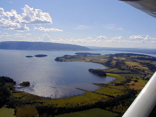
09 village sylling and lake tyrifjorden norway
Tyrifjorden (Lake Tyri) is Norway's fifth largest lake with an area of 137 km2. It has a volume of 13 km3, is 295 meters deep at its deepest, and lies 63 meters above sea level. The lake's primary source is the Begna river, which discharges into Tyrifjorden at Hønefoss where the river forms the waterfall of Hønefossen. Its primary outlet is at Vikersund near the lake's southwest corner, where Tyrifjorden discharges into the Drammenselva river.
Contents
- 09 village sylling and lake tyrifjorden norway
- Map of Tyrifjorden Norway
- LocationEdit
- BranchesEdit
- IslandsEdit
- The nameEdit
- 2011 shooting massacreEdit
- References
Map of Tyrifjorden, Norway
LocationEdit
Tyrifjorden is located in the county of Buskerud and borders the municipalities of Hole, Lier, Modum, and Ringerike. Tyrifjorden is a landlocked fjord. It consists of a main body, Storfjorden, along with the Holsfjorden, Nordfjorden, and Steinsfjorden branches.
BranchesEdit
IslandsEdit
The nameEdit
The Old Norse form of the name was just Tyri (or Tyrvi). This uncompounded name is also the first element in the name Tyristrand. The name is derived from the word tyri meaning "old/dead pine (wood)", referring specifically to the woods of the western side of the lake. The last element -fjorden (the finite form of fjord) is a later addition.
2011 shooting massacreEdit
On 22 July 2011, an island in the lake, Utøya, was the site of a shooting spree during a youth camp held by the Norwegian Labour Party.