Postcode(s) 3490 Elevation 96 m | Postal code 3490 | |
 | ||
Location 498 km (309 mi) from Melbourne175 km (109 mi) from Mildura12 km (7 mi) from Cowangie9 km (6 mi) from Boinka | ||
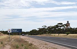
Tutye is a locality situated on the section of the Mallee Highway between Ouyen and the South Australian border in the Sunraysia region of Victoria, Australia. The place by road, is situated about 9 kilometres southeast from Boinka and 12 kilometres northwest from Cowangie.
Map of Tutye VIC 3490, Australia
A Post Office opened on 15 July 1912 when a regular mail service was provided by the opening of the railway line from Ouyen to Murrayville a month earlier. The office closed in 1980.
The area of the locality contains the smaller area of Tyalla.
References
Tutye, Victoria Wikipedia(Text) CC BY-SA
