
Surface area 0.19 km (0.073 sq mi) Max. depth 33 m (108 ft) Mean depth 14 m | Average depth 13.6 m (45 ft) Surface elevation 1,763 m Catchment area 220 ha | |
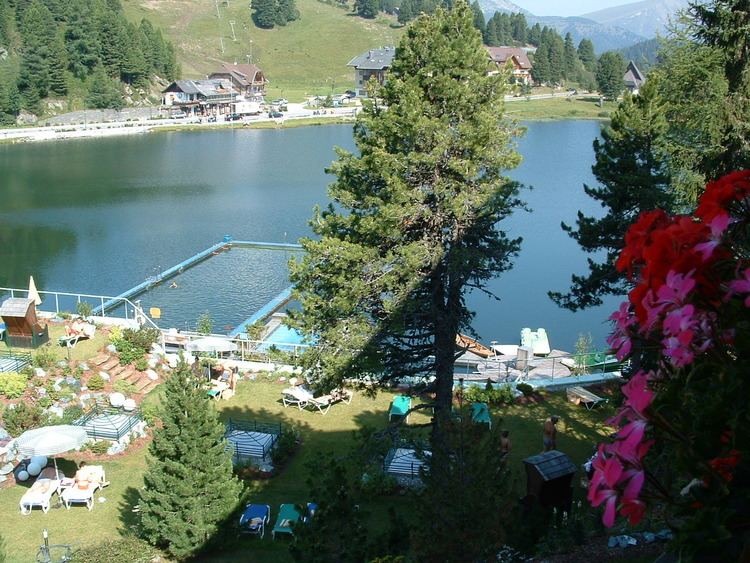 | ||
Lake Turrach (German: Turracher See) is an Alpine lake at Turracher Höhe Pass, on the state border of Carinthia and Styria in Austria.
Contents
Map of Turracher See, Austria
GeographyEdit
The lake is located within the Gurktal Alps (Nock Mountains) at a height of 1,763 m (5,784 ft) above sea-level. Due to the altitude, it frequently freezes over in winter. In summer, the water temperature can reach a maximum of 18 °C (64 °F); the waters therefore are hardly used for bathing, except for a hotel beach on the southern shore equipped with thermal pumps.
Lake Turrach is fed by a mountain stream and several marshy meadows, the water drains northwards into the Styrian Mur valley at Predlitz. It was the first Carinthian lake to be protected from the discharge of wastewater by a sewage system. Today, several species of fish occur, among them brown trout and arctic char.
Since 2012 the Carinthian part of the lake belongs to the UNESCO Salzburg Lungau and Nock Mountains biosphere reserve.