
Urban settlements 0 | Rural localities 5 Area 43,770 km² | |
 | ||
Municipally incorporated as | ||
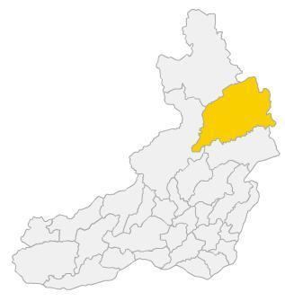
Tungiro-Olyokminsky District (Russian: Тунгиро-Олёкминский райо́н) is an administrative and municipal district (raion), one of the thirty-one in Zabaykalsky Krai, Russia. It is located in the northeast of the krai, and borders with Kalarsky District in the north, Mogochinsky District in the south, and with Tungokochensky District in the west. The area of the district is 42,900 square kilometers (16,600 sq mi). Its administrative center is the rural locality (a selo) of Tupik. Population: 1,432 (2010 Census); 1,643 (2002 Census); 1,899 (1989 Census). The population of Tupik accounts for 67.8% of the district's total population.
Contents
Map of Tungiro-Olyokminsky District, Zabaykalsky Krai, Russia
History
The district was established on January 6, 1927.
Economy
The district is rich with gold, silver, lead, and other natural resources.