
Elevation 4,687 ft (1,429 m) Mountains Sentinel Peak | Highest point Sentinel Peak Country United States of America | |
 | ||
Topo map USGS Cat Mountain, Arizona,Jaynes, Arizona,Avra, Arizona,Brown Mountain, Arizona | ||
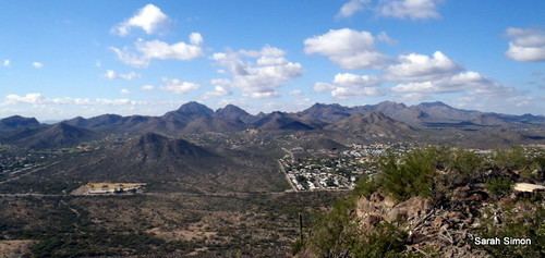
The Tucson Mountains (O'odham: Cuk Doʼag) are a minor mountain range west of Tucson, Arizona. The Tucson Mountains, including Wasson Peak, are one of four notable mountain ranges surrounding the Tucson Basin. The Santa Catalina Mountains lie to the northeast, the Rincon Mountains are to the east of Tucson, and the Santa Rita Mountains lie to the south. Additionally the Sierrita Mountains lie due south, the Roskruge Mountains lie to the west across Avra Valley, the Silver Bell Mountains lie to the northwest, and the Tortolita Mountains lie to the north across the Santa Cruz Valley.
Contents
Map of Tucson Mountains, Arizona 85745, USA
Parks and preservesEdit
The Arizona-Sonora Desert Museum is located on the west flank of the Tucson Mountains. Much of the range is protected by Saguaro National Park and Tucson Mountain County Park. Old Tucson Studios are located just west of the Tucson Mountains.
Tucson Mountain Park was established April 1929. The Pima County Parks Commission, with C. B. Brown as its chairman, was established to oversee the park. At approximately 20,000 acres (8,100 ha), the park is one of the largest natural resource areas owned and managed by a local government in the U.S. The park has approximately 62 miles (100 km) of non-motorized shared-use trails. The area is popular with hikers, mountain bikers, and equestrians.
Saguaro National Park was created as a National Monument in 1933 and later designated a national park in 1994. The Tucson Mountain District of Saguaro National Park ranges from an elevation of 2,180 ft to 4,687 ft and contains 2 biotic communities, desert scrub, and desert grassland. Average annual precipitation is approximately 10.27 in. Common wildlife include the coyote, Gambel’s quail, and desert tortoise.
According to historian David Leighton, Brown Mountain in Tucson Mountain Park, is named in honor of park founder, C.B. Brown, Kinney Road the main thoroughfare thru the park, is named for Pima County Supervisor, Jack C. Kinney who worked with Brown in the creation of the park and McCain Loop was named for J.C. McCain, the first park ranger.