
Headquarters Judba Number of Tehsils 2 | Established 2011 Time zone PST (UTC+5) Area 497 km² | |
 | ||
Torghar District (Pashto: ضلع تور غر) or Tor Ghar (lit. "black mountains"), formerly called Kala Dhaka (Hindko: کالا ڈهاکه), is the smallest district of Pakistan and one of the 26 districts of Khyber Pakhtunkhwa, Pakistan. Under Article 246 of the Constitution of Pakistan, Torghar officially separated from Mansehra District to become its own district in 2011. At the 1998 census, the Mansehra subdivision then known as Kala Dhaka had a population of 174,700, 96% of which had Pashto as their first language.
Contents
Topography

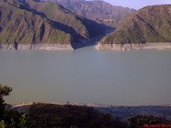
It lies between 34°32' and 34°50' N, and 72°48' and 72°58' E. It is bounded on the east by Agror and on the south by Tanawal; to the west it is bounded by Buner, to the northeast it borders with Battagram. The range has a length of 25 to 30 miles from north to south and an elevation of 8,000 feet above sea level. This area has also been called Chagharzai, because of adjoining Chagharzai areas of Buner District. Opposite Kala Dhaka (officially 'Kala Dhaka' has been renamed 'Tor Ghar'), across the Indus River is Shangla District, mainly the area belonging to Tehsil Martung.
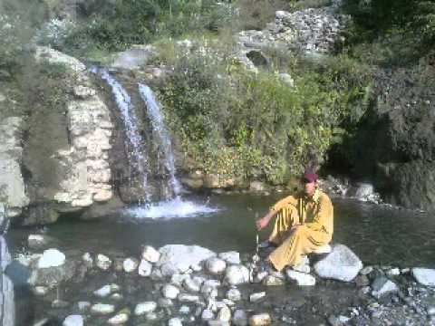
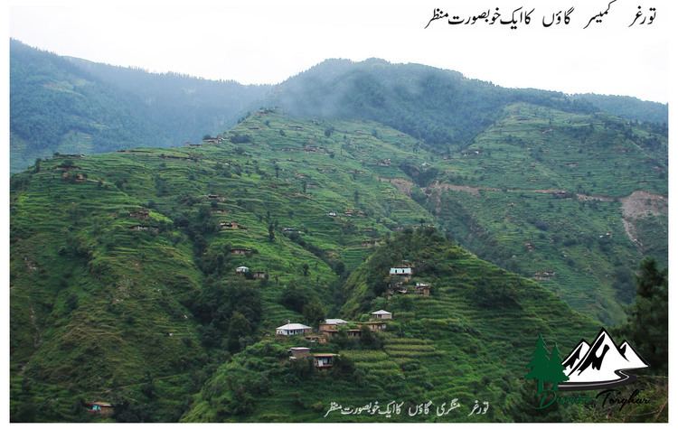
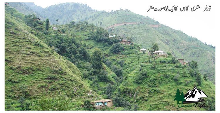
The Indus washes its northern extremity and then turns due south. Between the river and the crest of the range the western slopes are occupied by Yusufzai Pakhtoons. The rest of the range is held by Swatis tribal group of Pakhtoons. The Black Mountain forms a long, narrow ridge, with higher peaks at intervals and occasional deep passes. The highest peak is known as "Machay Sar" and is visible from Agror and other adjoining areas. Numerous spurs project from its sides, forming narrow gorges in which lie the villages of the tribes. The upper parts of the ridge and spurs are covered with thick forests of pine, oak, sycamore, horse-chestnut, and wild cherry; but the slopes are stony and barren.
Administration
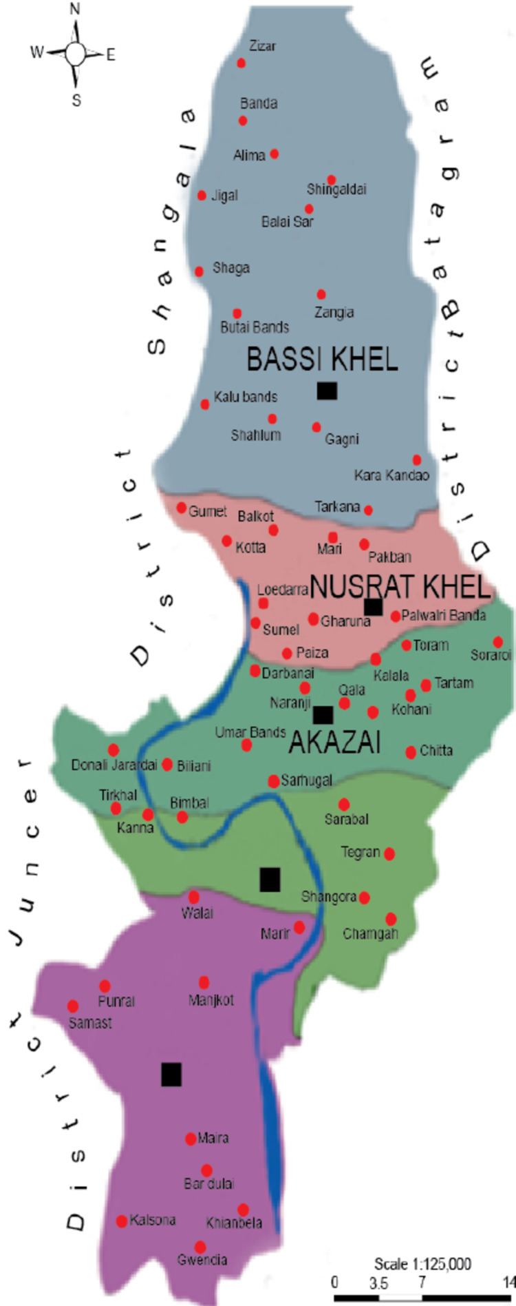
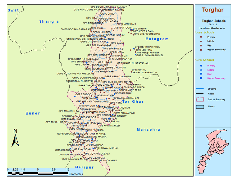
Torghar is a district of Khyber Pakhtoonkhwa. It covers an area of 497 km2 (25,8125 acres) and is divided into 16 Union Councils.
History
The Torghar (Black Mountain) massif was a series of spurs running up to a central, dominating ridge line, which reached 9817 feet at its highest peak, the peak of Machai Sar. Along this ridge ran the line beyond which the British writ did not run, though the local tribes lived on both sides regardless. It has 5 major tribes, Bassi khel, Mada khel, Akazai, Hassanzai, Nasrat khel. Each tribe have subtribes The area was not on road to anywhere and the British had been happy to let it be; unfortunately the inhabitants were not inclined to let them do so. They were warlike, and in some cases, religiously motivated against the British. Politically, they were nominally under the influence of two independent princelings, the Nawab of Amb and the Wali of Swat, but these exercised little real power in the hills. On the eastern mountain, nearest British territory, lived the Swatis.
The British sent more than four expeditions to subdue the Black Mountain tribes between 1852 and 1892 because Ata Mohammad Khan Swati, the Khan of Agror and Arsala Khan of Allai, and his sons intrigued against the British government.
In 1851 two officers of the British Customs (Salt) department within the borders of Tanawal were killed, allegedly by the Hasanzai sect of the Yusufzai. The British then sent an expedition under Colonel Mackeson, which destroyed a number of tribal strongholds. In 1868 the Yusufzai, instigated by the Khan of Agror, who resented the establishment of the police post at Oghi in the Agror valley, attacked that post in force, but were repulsed. Further attacks on the troops of the Khan of Tanawal, who remained loyal, followed. This culminated in a general advance of the The Black Mountain (Tor Ghar) Tribes against the British position. It was repulsed, but not until 21 British villages had been burnt, and a second expedition under General Wilde had overrun the Black Mountain and secured the full submission of the tribes.
"The Black Mountain adjoins the territory of the Wali of Swat. It is so called from the dark forests of that cover its slopes. The eastern sides are held by the aboriginal tribes of Swat called swatis.The western ridge is the homeland of Yousafzai tribes. There is constant struggle among small tribal chiefs. The most important of these is the Nawab of Amb. He enjoys the unique distinction of being an independent chief across the Indus. The Nawab of Amb has an arms factory. He manufactures rifled cannon. This cannon can throw a solid ball 3000 yards. It is a useful weapon for pounding to pieces a tribal fortress."
In 1888 the British blockaded the area due to the raids by the Hasanzai and Akazai aided by the Madda Khel into the Agror valley. While more stringent measures were being organized, Major Battye and Captain Urmston and some sepoys of the Fifth Gurkhas were surprised and killed by Gujar dependents of the Akazai. Hashim Ali, the head of the Hasanzai and Akazai, was suspected of having instigated the attack. An expedition was sent in the same year, with the result that the tribes paid the fines imposed upon them, and agreed to the removal of Hashim Ali from Tor Ghar and the appointment in his place of his near relative and enemy Ibrahim Khan (Hasanzai Tribe Elder). In 1890 the tribe opposed the march of troops along the crest of the Black Mountain, and an expedition was sent against them in the spring of 1891. Immediately after the withdrawal of the troops, the Hindustanis and Madda Khel broke their agreement with the British Government by permitting the return of Hashim Ali Hasanzai. A second expedition was dispatched in 1892 which resulted in the complete pacification of the Black Mountain border.
2005 earthquake
Torghar was badly affected by the 2005 Kashmir earthquake, according to a report in Time magazine: "Entire villages were devastated; in an instant, stone houses turned into burial mounds. The Indus river, flowing at the bottom of the valleys, recalls one tribal elder, Mohammed Said, "looked like water boiling inside a tea kettle".