
Length 30 km Source elevation 192 m | Basin size 147 km (57 sq mi) Basin area 147 km² Source Lipovička šuma Country Serbia | |
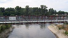 | ||
Topčiderska reka (Serbian Cyrillic: Топчидерска река; literally, Topčider river), or colloquially Topčiderka (Топчидерка), is a river in north-central Serbia, a 30 km-long right tributary to the Sava river to which it flows in the urban section of Belgrade. It is one of the 40 rivers, streams and creeks that flow or used to flow through Belgrade (majority of them is conducted underground into the city sewage system).
Contents
Map of Top%C4%8Diderska reka, Belgrade, Serbia
Course
The Topčiderka originates in the Lipovica (Lipovička suma) area, on the northern slopes of the Parcanski vis, the northern section of the Kosmaj mountain, at an altitude of 192 meters. Originally, it flows to the north-east, until it reaches the Belgrade's suburb of Ripanj, in the municipality of Voždovac. From there, the river flows generally into the north-west direction, along the Šumadija's geological bar into which the river carved its epigenetic valley and formed a watershed. The valley of Topčiderka is a natural route for the Belgrade-Niš railway.
After it flows between the villages of Pinosava and Rušanj (western slopes of the Avala mountain), the Topčiderka enters the urban section of Belgrade (Rakovica municipality) at the neighborhood of Resnik. It continues through the neighborhoods of Kijevo, Labudovo Brdo, Kneževac, Rakovica, Miljakovac and Kanarevo Brdo.
At this point, the river enters the territory of the municipality of Savski Venac where the vast woods of Topčider are formed. After the Topčiderka passes next to the Konak of Prince Miloš and the Belgrade's hippodrome, it empties into the Čukarica Bay of the Sava river, across the northern tip of the Ada Ciganlija island, at an altitude of 69 meters. It drains an area of 147 km² (out of which 70% is agricultural land) with 35 tributaries and belongs to the Black Sea drainage basin.
Tributaries
Tributaries of the Topčiderka include:
Pollution
Despite its river bed has been arranged and concreted in majority of its urban course, the Topčiderka still floods the surrounding areas of Belgrade during heavy rains. Over 160,000 inhabitants lives in the urban section of Topčiderka. As a result of high density of population and sewage systems, industrial zones the river passes through and advanced erosion, Topčiderka is notoriously highly polluted, which resulted in City government's 2007 Study on cleaning the river and its drainage basin, which was officially presented in May 2008. The study is the first ever complete collection of measures for Topčiderka improvement. Concrete bed for the further 7 kilometers are projected, so as the seven small reservoirs (added to the already existing two) which will prevent floodings and make irrigation possible. City architect, Đorđe Bobić, stated that "once we protected the city from the river, now the time has come to protect the river from the city".