
Country Honduras Villages 13 Population 6,495 (2015) | Department Lempira Area 48 km² Local time Sunday 8:36 AM | |
 | ||
Weather 23°C, Wind SE at 6 km/h, 67% Humidity | ||
Tomalá is a municipality in the Honduran department of Lempira.
Contents
Map of Tomal%C3%A1, Honduras
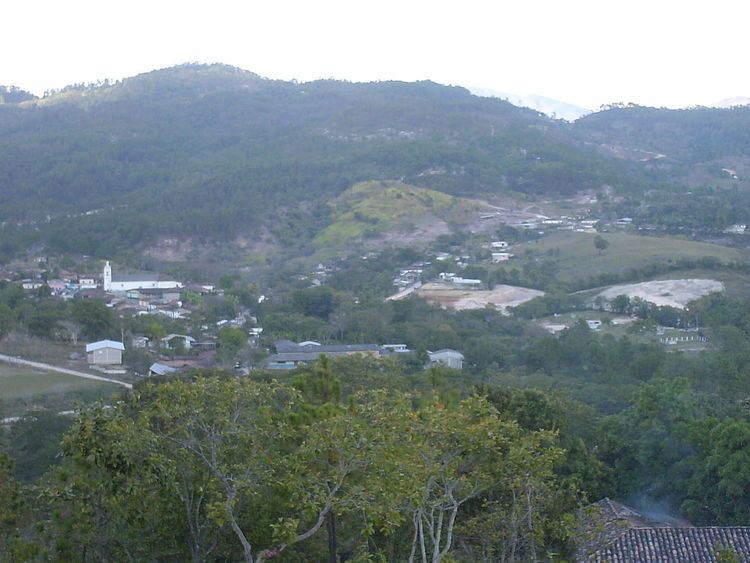
It is one of the smallest municipalities of the Lempira department in Honduras. It is situated 10 minutes away from Tambla municipality.
History
It started as a small village back in 1576. Since it was originally located on a swamp, the community decided to relocate it onto the toe of a hill, and it has been there ever since. In the census of 1791 it was a town belonging to "Curato de Sensenti" and in 1889 it was a municipality of Guarita district.
Geography
It is situated at the top of a mountain. There are also huge mountains around the municipality capital. All of these are covered with Pine forests. The weather is very cool along the year, except for the summer because it increases a little.
Boundaries
Its boundaries are:
Population
In Tomalá the cross-breed of Spanish and Indians represent 80% of the people. The rest is taken by Indians descendants who live in the villages around the municipality capital.
Tourism
In order to arrive to its municipality capital is better to go via Santa Rosa de Copán-San Marcos de Ocotepeque-Cololaca-Tambla. It takes about 2 hr, the road up to Cololaca is being paved, but once one passes Cololaca the road is in very good conditions. This town will sure a very pleasant visit for the traveler, because it is located at a very quite and nice place, with many Pine forests and magnificent views to other mountain ranges, especially "Congolón". The parades and holidays are very crowded for their entertainment and "showy". The people are very welcoming and nice as well. Its church is dated 1904, and they take good care of it. It looks like time never passes by in this place.